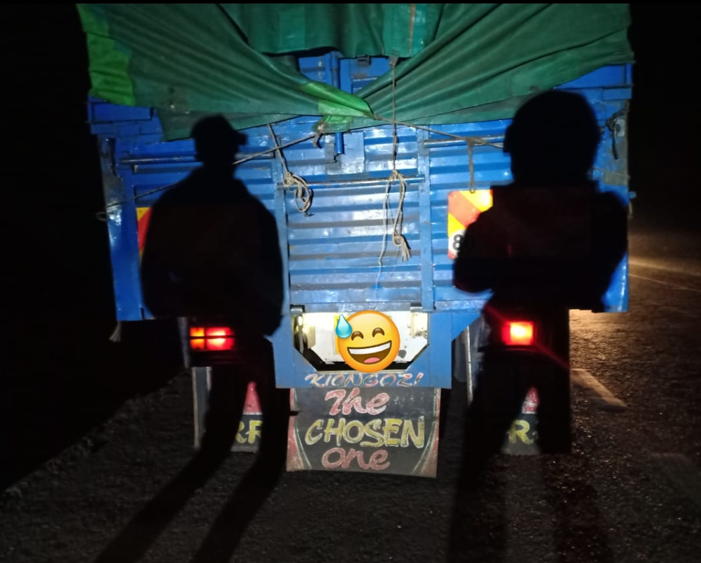
My bike, tent, a book and me. I plan to fall off the grid completely for my January leave.
A TZ roadtrip to Lake Tanganyika sounds amazing until I read up on our neighbor’s rain seasons. Maybe I explore the greenery of Western Kenya instead?
That’s when my pal talks about riding to some remote places up North. This hits the right spots in my brain. A ride around Lake Turkana?
Turkwel hinterlands. Turkana Boy. Kibish. The Ilemi Triangle! Ethiopia. Finally to Ileret! Through Koobi Fora and Sibiloi National Park. And a chill return through Loiyangalani. Two weeks of stones and sand.
Security around Kibish was now better based on our intel but the big unknown was crossing the Ethiopian border considering their state of emergency and some customs and pandemic questions.
We put together our route ideas and come up with 3 options upon reaching mwisho wa nchi in Todonyang: Explore the Ilemi triangle and proceed to the Marsabit side via Ethiopia (Omorate), or if that would prove difficult take a boat to Ileret – or if all fails, return to Western from Kibish along the Ugandan border.
All 3 options sound epic. The full plan would have around 2300km of which around 750 tarmac.

The stars start aligning nicely when I email the Catholic Mission in Todonyang and they actually respond and two of their staff happen to be in Nairobi and meet me for coffee. On the same day I bump into Hamish, an adventure rider, at Pallet and he shares good vybes and photos from a recent ride he did in the area.
Between finishing up work assignments we manage a pre-meeting to think through the logistics: luggage, tents, first aid, cooking equipment, food, tools, bike spares. I am keen to stay below 15kgs luggage.
We plan to be self-reliant for at least 4 nights. I frisk Carrefour but the best menu we come up with were some vegetables and githeri in tins and noodles. And tortillas with tuna. Why is there more tinned cat than human food?

I am carefully optimistic about my bike and relevant riding skills. Something always breaks on my trips (you just never know what!), but I had gotten a few crucial parts of the bike replaced recently, which were worn out by previous adventures.
I just clocked 22,000 km in my riding career and am slowly graduating from the advanced beginner status. I’ve done around 1,200km adventure off-roading so far, nailed sand riding on my Loiyangalani trip (link) and successfully tested gravel riding with luggage over Christmas (link). The days through Sibiloi would be the most challenging, with the few people I know who’ve ridden there saying it’s difficult and rough riding terrain.


The final question on my mind is whether my pal and I will kill each other on this trip.
Have you met Djo Thefu? He rides 7 times my engine size and I’m far more chatty than his introvert nature might handle. He’s a Tutajua Tu person (“We’ll see”) and I love some good old German certainty. There was only one way to find out.
When we exchange emergency contacts on the first day of the trip, it feels like a trust pact is signed to get each other home safe, or at least ‘somewhere safe’.
How do you write about such a journey?
One that Djo will also write about? After all he’s one of our if not the best story teller of 254 adventure riding.
Well, this is my story of riding around Lake Turkana. The 125cc story, one of a lover of the universe, of curiosity and encounter, a story of a woman singing over the bones!
Enjoy!
PS: Y’all signed up on DjoThefu Stories, I assume? We certainly hope you’ll choose to pay the premium subscription. It allows you to contribute towards the trip and writing efforts, and indulge in brain-teasing narrations for 3 months for less than a boda’s oil change.
Day 1 – To Kainuk (Turkana) via Chemolingot (off-road route)
My co-rider’s Super Tenere is faster and more comfortable, so he’s cool to ride the 400k plus to Kainuk in a day, but considering there’s another 10 days off-road following, I’m not feeling it. We agree to meet at Marigat and hit the rough road together from there.
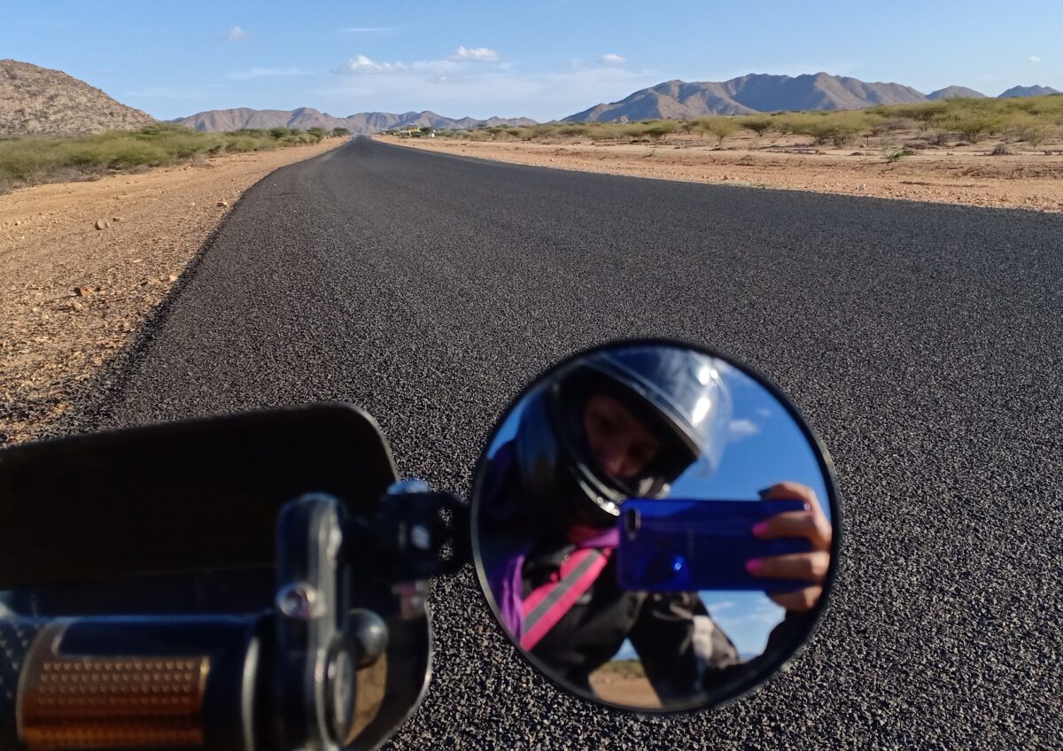
I arrive at Nakuru the night before in an eventful night ride (link) that has me replace a mirror and curse a driver to suffer a painful death. I aim to leave Nakuru at 8 but boy, the traffic jam is unexpected! Once out of town through Kabarak, the road is empty.

After unsuccessfully stopping at several spares shops for an extra clutch cable, I get some work done at the lounge of Hope Cottages in Marigat.
Djo arrives at Shell Marigat around 12:45pm. That guy looks so prepared. He could probably survive on the moon. Looking at his luggage I wonder what exactly I forgot at home and what drama it will cause somewhere in a stone desert.

We hit the remaining tarmac towards Chemolingot. I am soooo curious how the day will go. 13 months ago I went to Eliye Springs via this route at the beginning of my offroad riding career (link) and had several heart attacks on the gravel, crossing rivers and ended up breaking a foot peg.
A lot has improved:
Near Loruk the lake had swallowed the road, but has since released it again. The tarmac is destroyed but it is dry to pass. The offroad from Chemolingot was graded and is far less bumpy, and the down hills are less gravely. 3 or 4 bridges are done where last time I had to ride through rivers (or rather ask another rider to do it for me).


Oh – and my bike handling skills and confidence have gone up 10 fold. It’s an enjoyable route in Baringo and then West Pokot counties and we zoom between the hills at around 40-55. I’m relieved that we’re getting the opportunity to get in sync on simple rough roads before the more adventurous stages. I love stopping for pictures and it turns out this works well for him.

This is also the day Djo introduces Akoth to the general public. At this point I don’t know yet that this will be my best documented roadtrip ever, photographically speaking!

We reach the tarmac at Marich Pass at sunset, by around 6:50. It is another 20km to our destination (Calabash – which you will find directly on the right side of the highway marked by two sign posts, not where Google Maps says it is), but I have a work call at 7pm so we stop so I can take it from there. The network collapses halfway through my call from a brilliant 4G to “don’t even try to send an SMS!”. Djo has been waiting for an hour for me, and as I give up on my call and we depart, he somehow drops his prescription glasses. We ride to Kainuk in darkness and as he notices, we turn around to look for them, but to no avail.
And this is where the losting of dear and useful items on this trip starts!
We check in at Calabash approx 10km before Kainuk around 10pm. Some locals watch a Chinese kung fu style movie on TV but the kitchen is “closed”. Well, just that it’s open and I can see the pans from afar. We convince a lady on staff to warm one of our githeri tins and cook rice for us. This simple dish tastes heavenly after a long day of dust and oxygen.
The full moon shines through the trees and I enjoy a bucket shower outside my hut. I feel tranquil and invigorated at the same time. I really need this trip: A break for myself and to link up my soul and nature.
310km done, of which 100 rough road!
Day 2 – Kainuk to Lodwar via Naipal (the sand!)
We wake up and pack our stuff. There’s something about luggage on a bike: You carry the same same stuff, but it fits differently every single day!

We head to Kainuk for fuel and water. Yeah, this picture is Kainuk in Turkana county. Street lighting and tarmac you won’t find in most Nairobi estates.

From here we head onwards to Turkwel Dam on a tarmac road. I have passed this junction before. Not once. I was told it’s not safe to venture in here. And that there’s not much to see anyways.

Today we will explore this route for over 180km and let me not pre-empt, but people say a lot of things. If there’s one thing to take away from this whole story it is to choose your dreams. Give the potentially epic a chance. Lean into your curiosities. Go for it! 💃 ✨
But first we run into a barrier. We’re told there’s a 100 bob charge ya county for using this road. It doesn’t exactly add up, because there really is no other road to most of the towns behind this point. We ask for a receipt which is duly written but I’m very sure the money won’t reach the county.

As we reach the gate of the Turkwel Dam & Power Station, the security team explains to us the registration procedure. We proceed to meet the in-charge in his office for a chat and I scout the staff quarters in search of a toilet. Yeah, the sum of these little detours is what usually gets you in trouble at the end of the day, but what’s the point of coming all the way up here without a little exploring?

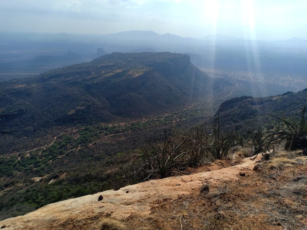
We then ride on to the dam through some steep mountain twisties with amazing views. What looks like a railway line built by aliens are the power lines to evacuate the power. Djo shows off some cornering skills and once at the hilltop we roll on downwards until we spot water.


As we reach the dam itself, we’re informed that we’re not allowed to take pictures for security reasons. Is this a technology patent issue or do terrorists need close-up photos to destroy this important piece of infrastructure? We stroll around the dam wall for a few minutes, but on realizing the time, decide to start moving.
Now, the off-road starts right at the bottom of the hill. Beautiful scenery, twisty narrow gravel track through trees and dry rivers. On dirt I usually need a few kms to sync with the bike and road for the day. Djo quickly disappears in front of me as I feel my way into the bumpy, slippery surface. I chuckle at this terrible start.
We had been told of an option of connecting from Nakwomoru to the main tarmac near Kalemngrok through a bridge, but aren’t exactly keen to do the Lokichar route. Djo in fact hates the idea and throws me a stern, disapproving look for even entertaining the thought.
It gets smooth and fun, and we drop the idea of the bridge to the tarmac fast. Riding through the villages, I get some fascinating micro glimpses into the Turkana culture. The place feels fairly untouched, much better than the highway experience. Young boys mind large herds of cattle. A mzee approaches Djo and it turns out he’s the same mzee who was earlier called by the camp staff to identify a good route for us.
At some point I stop and retreat behind a thorny bush for a call of nature and place my hip bag on my bike. That’s the last time I see it. When I realize 20km of sandy trails later that I must have lost it, I quickly calculate whether it’s worth going back. If we go look for it, we will surely be caught in the dark up in the sandy Turkwel river near Lodwar. I have my ID, DL and spare bike key in my jacket. My power bank and first aid kit is in my backpack. Thankfully! I calculate that the hip bag only had my backup water bottle, tissue paper and sunscreen, so I decide to let it go and hope that whoever finds it will enjoy using it.

In one village we find a group of 20 young men sitting under trees. We park in the shade to drink some water and one helpfully approaches us in English and guides us on the way “We’re discussing some issues we’re facing”.
As we ride into Naipa for a really late lunch, we find elders chilling under a tree along the road on the traditional pillows (with my best English let me describe it as an elevated wooden plate). As we climb off the bikes and stretch, the kids assemble in colourful wear. I am not sure if they were 50 but they were many.
Someone points to the one hoteli, where we are served pilau in the backyard of someone’s house next to some baby goats tied to a tree. The kids stand around the bikes and watch us eat from across the fence. Some guy keeps running around with a huge knife, while another one offers to bring the bikes to the backyard, probably in hope of a tip. It’s equally magic and ridiculous.

We have to keep moving, with 87km to go and the sand intensifying.


I’m getting better at sand! I raised my handlebar slightly juzi and am now able to sail the laggas standing. It’s a complete game changer on sand, as the bike’s wagging tail tickles my control freak brain far less. I use Shakir’s vroom vroom technique and it sure does work. I can’t believe my luck and practice this at different speeds and try different standing postures. Even Djo is getting better at sand! The Super Tenere is not light but we’re moving at 30-45.
Bodas recommend a panya route that turns out to be an epic single track between trees. I start singing in my helmet. And noone is falling!


Then we get to Turkwel River – a 400m wide sand river that I well remember from last year’s Eliye trip. The sun is setting. We slide around in the tire tracks. Camels are crossing. We goof around and pose for pictures.

Bodas try to block our pictures, demanding cash to photograph ‘their’ camels. It’s one magic sunset experience. I feel like staying forever, yet it’s another 40 clicks to Lodwar!!


Chasing sunlight on medium to deep sand for another 25km. I lose Djo far behind me. I hate the idea of leaving him but then again he’s probably better at lifting his bike alone than I’m able to ride in sand at night. At some point I stop and he catches up with me with the last sun rays. Ati he stoped to check on a vegetable garden project he once participated in 😳

I chase after a boda to find the best tracks for a few km, when miraculously – TARMAC! I can’t believe my eyes but do not argue with fate.

As we get to Lodwar town, the tarmac ends randomly and the mud puddles start. It must have rained just a few days ago. Maps navigates us to the Kobil peti and we fill up the tanks. From here we move onwards to a place we’ve both stayed in before (Gracious Guest House) and find the entrance demolished for road constructions. We can’t be bothered otherwise and ride through the neighbours plot to reach the gate.
After haggling for the room rate, we’re served some delicious fish and I’m jubilant enough to order a cold beer.

Day 2 done – 225km, of which 160km offroad/sand.
Djo and I don’t talk much over dinner, and instead exchange photos of the day. We experienced the exact same trip and I marvel at how our lenses capture and our social media posts process the moments uniquely. He’s a comms specialist and artist and I start thinking that he’s probably really good at what he does: telling stories that stick and move people.
Day 3 – Lodwar to Nariokotome
It’s a beautiful, calm Sunday morning. I sing through a whole gospel album while showering. Then we take a stroll through Lodwar looking for breakfast and top up some canned food at Kakumatt Supermarket.

One of my biker friends who follows my road trips inquires whether there have been any mechanical challenges on this trip so far. I send him a side eye emoji, not yet knowing that I’ll later squarely blame him for how the day ends. B, you know yourself!
Leaving the hotel through the demolished entrance is slightly easier now that we can actually see what we’re navigating.

We head out to Kalokol via the tarmac, which has been extended towards the lake. Gunias of dried fish are carried towards Lodwar by bodas.

On our touristic to-do list were the Nasura Pillars, which we find freshly fenced but inaccessible. We take pics through the fence and hope that future visitors will be furnished with helpful information about this prehistoric cultural site.

The last handful of kms aren’t yet tarmacked and roooouuugh.
Once in Kalokol we enlist a welder to reinforce my right footpeg which has suffered southwards from the 100km of standing on the bike yesterday. I’m not taking it personal. He also fashions a pair of tire levers, as somehow Djo’s got lost. 😏

We then look for lunch and start moving up North at 3pm or slightly after. The fun begins. We have 75km to cover up to Nariokotome. Riding parallel to the lake shore will mean crossing all rivers flowing toward the lake. From Google Maps Satellite we can see at least 10 wide river crossings and hundreds of small ones. With “river” of course we mean lagga, a.k.a. sand. It had recently rained heavily which ideally would help us find juicy sand. Still: By our calculations we are at least 1 hour behind our plan already.
The road has corrugations and seems relatively busy with proboxes and bodas. After the beautiful previous day on empty remote tracks even a car every 5 minutes feels rudely crowded. The sand turns darker and there are some pebbles and stones.

We find one truck stuck in a deep muddy river. The rain must have been nuts and we’re glad we’re here at the exact right time.

The sand here feels different than the one yesterday. It’s less compact and I slide more. Sand is not forgiving to a hesitating throttle hand. I’m also trying to do good speeds and on a downhill I get overly creative with my choice of lane and randomly hit a deep hole. Of course I go down. Djo might have died of laughter behind his balaclava but helps me lift the bike without showing it.
In my entire riding career I have dropped my bike less than 10 times. From the top of my head I can remember two drops on the Loiyangalani trip, one in Taveta sand, one in Naivasha on a slow tarmac right turn and two side stand faints in hilly Murang’a. In the spirit of letting go, I’m about to generously double or even triple my stats on this trip.

After crossing a river, I realize the front light is somewhat loose. As I stop to figure out what is going on, I see that the entire metal holding the headlight broke off. It’s 6:20pm.
We try to tie it with bungee cords, but it doesn’t look like it’ll work on the bumpy road, so I suggest to remove the light entirely.

We unclip the connections, put the light in Djo’s bag and calculate that we have less than 10km of sunlight left – unlikely to even reach the next small town, Nachukui. We try. At some point I pass a sizely homestead and it hits me that it might be a better bet to camp at someone’s home than going to a small town after dark trying to convince someone at the shopping centre to allow us to camp.
We agree that I will go to the homestead and ask for permission. Less threatening. I talk to the lady in Swahili but as the mzee is not home, we don’t get far. Without male permission we won’t camp anywhere, reasons Djo and suggests we ride back a bit where he saw men walking.
Turns out one of them is the local teacher. Jackpot! Boniface is heaven-sent, one of the many angels we meet on this trip!
He brings the school’s gate keys and allows us to pitch our tents, and shows us where the rain water is kept. I take a shower with two litres of rain water, while Djo cooks dinner.

Today we did around 120km, of which 50 tarmac.
I lie on my bike and watch a million stars in the dark Turkana night. The locals are singing and playing drums – we’re later told they’re celebrating the rains. I feel blissful listening to them – my back is stiff and hurts, so I decide to stretch a bit on the ground – reluctant considering there could be all kinds of crawling insects. After doing my part of the dinner chores (dishes), I sleep around midnight.
Day 4 – Road to Todonyang!
Waking up around 6:30 for sunrise snaps.

The intention was to fold and pack the tents so we are out before the kids arrive. But a conversation with the teacher about the school and the kids’ realities takes longer. When their nomadic families start moving in search of greener pastures, the kids drop out for some months.
Around 8, the kids start walking in one by one placing their piece of firewood and cup in the right spots and start playing. It’s just adorable how focused they are.

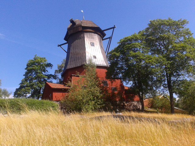
We buy some water in Nachukui and as we cross the lagga past town, on my left I spot a tall statue on the left. We ride up the river to find out what it is and enter a whole church compound complete with a windmill and walks of the cross. We spend an hour exploring the place and one of the catechists shows us around the church. It’s a beautiful church.
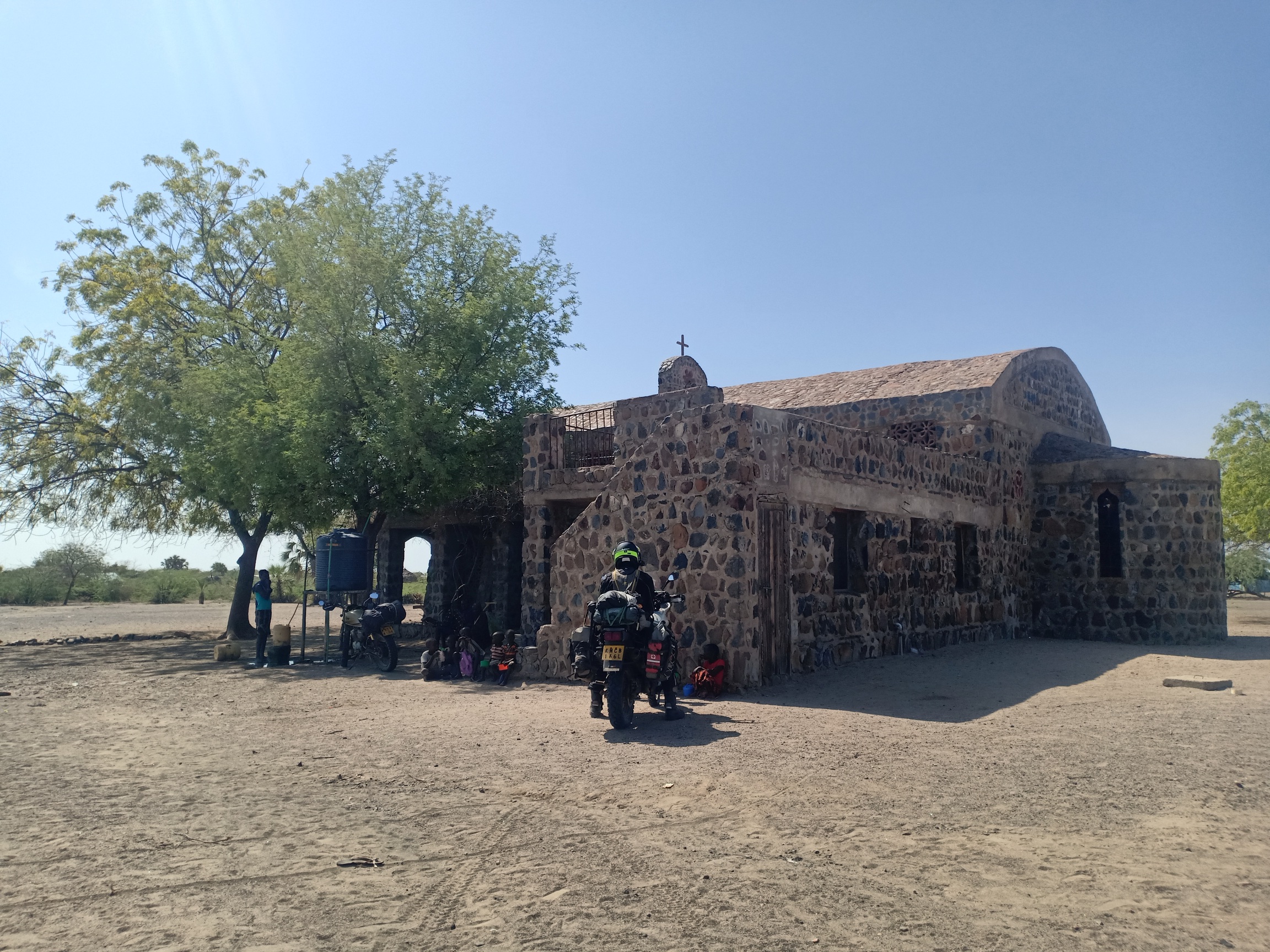

Ceiling paintings that would make Michelangelo rejoice.

We climb the bell tower and get the view of the area. The bell was made in Germany and has an engraving with an ubuntu type message in both German and Turkana.

We’re told that water is a huge challenge. Forget farming. Even just drinking water! All wells on the first 7-10km around the lake come out salty. You’d have to drill in the mountains and pipe the water down to the villages near the lake. Quite doable technology you would think! After all it would flow down by gravity.
But we’re told the politicians just come and talk. Ask for votes. Nothing happens. Over decades. So people survive on rain water and salty water. It’s nuts!
Another 10k of dry dusty throttling and we arrive in Nariokotome without much fanfare. Where the Turkana Boy was found. One of the touristic highlights of the trip! Hopefully it’ll work out, after the Kalokol pillar disappointment. We park at the locked gate. No sign, no phone number, no nothing.
A lady walks up to us, she is highly unwelcoming and mumbles some words that we can’t understand. Is it Turkana? Or Swahili with a strong accent? I sign the guest book as Akoth. The lady opens the gate and as we walk to the pillar, she says elfu mbili. 2k? We understand that for the last 10 days noone has signed the guest book, but wow. We didn’t expect to pay, especially with no official signs anywhere. Djo negotiates her down to 200, which is what we have in small cash. She gets properly pissed off, but given the whole exchange happens while walking we’re already at the skeleton (or rather the metal dummy skeleton).
We take a few snaps because there really isn’t much to see or read, or be told. The most complete prehistorical human skeleton ever discovered on this entire planet, and there is zero information. Facepalm.

We gear up and head onwards up North!
The scenery changes to bright sand again. A mountain range becomes visible on the left meaning we’re approaching Lowarengak. It’s a busy small town, larger than the other shopping centres we’ve passed. A mixed population and a bunch of shops and hotels. Nice flair. We strike up a boat option to help us cross the lake, should we not be able to ride via Ethiopia. The negotiations are stuck at 23k but we take the guy’s number anyways.
After lunch at Ghana Hotel, we chat with the owner about potentially crossing the lake via boat. He suggests to get some advice from the Maritime Police Patrol so we ride out to the beach.
They are highly reserved, but share the number of a boat person on the Eastern shore, who could pick us up.
Then back to the road and upwards to Todonyang. Now the road becomes even more deserted. It feels like no-man’s-land already! The tire tracks are very faint now and we ride through bushes between the lake and mountain. We stop a boda to ask if we’re on the right track. We’re basically 20km from the River Omo Delta and the Ethiopian border. Sand. Dried mud sand. At some point the risen lake comes close to the road.


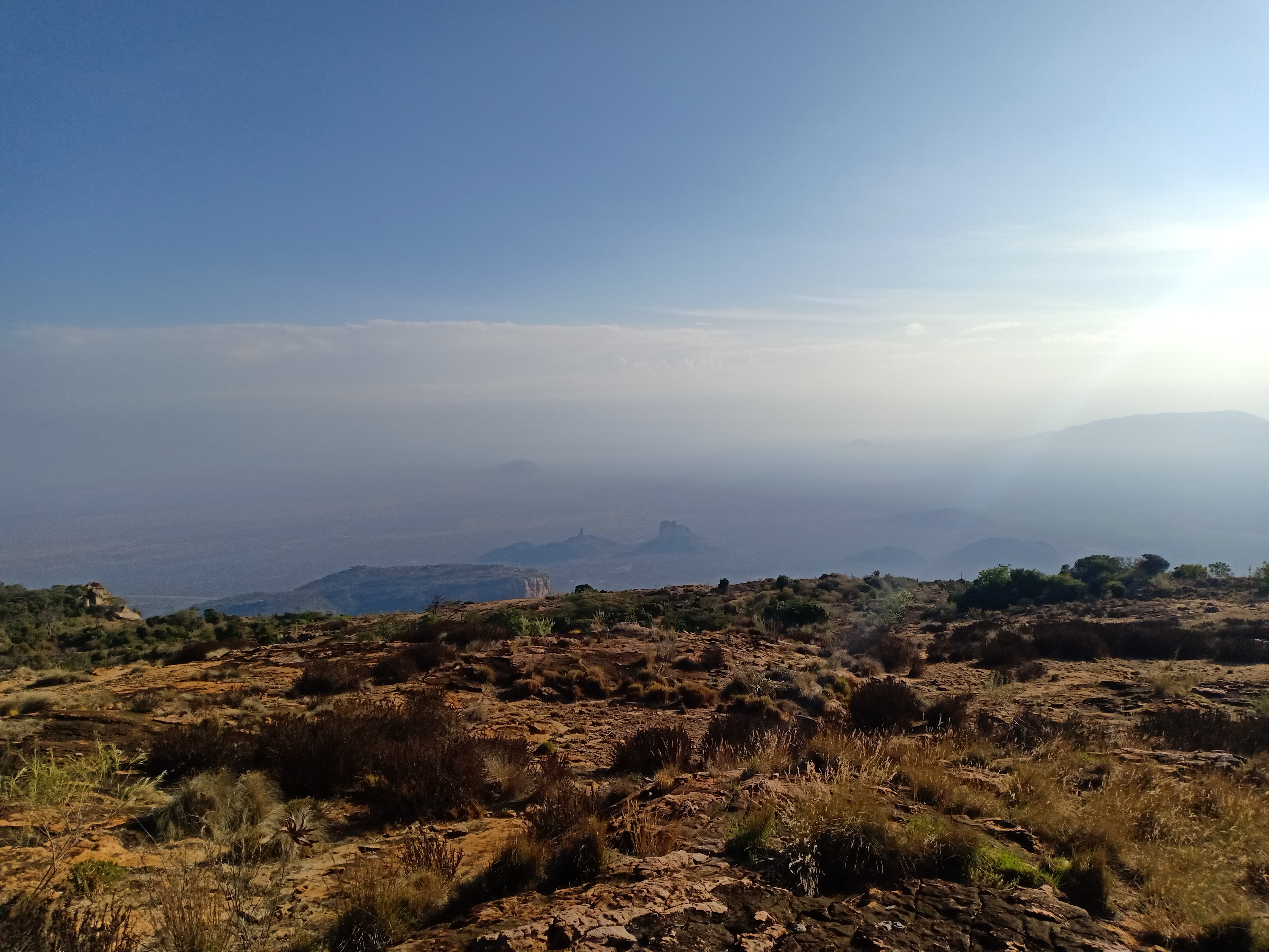
And then: Open square kilometres of empty plains. I’m cruising standing along the lake on flat land void of any plant. Breathtaking. I repeat. Pure bliss. I don’t think if I’ve ever ridden in such fresh air – I feel like removing my helmet and raising my arms while riding. I guess the dopamine just blew my mind.

We spot houses in the distance and a mobile phone mast. Sometimes you can’t wait to arrive and sometimes you want the journey to last forever.

We enter the gate of the Catholic Mission before 4pm. Our first day of arriving with ample day light – purely because we scratched the Lokitaung detour off the day’s route. They got a whole workshop for their cars and we fuel the bikes from bottles. It’s 180 per litre. The manager points us to the Father who shows us where to pitch our tents. I spend the rest of my afternoon washing my hair and doing some laundry. I also find that my period started – a whole 10 days early. Thankfully I have all my supplies but can’t help but wonder what triggered such a hormonal drop. Does this happen to other female riders, too?
This evening we chill with Fr. Wycliffe, who is in charge. Fr. Andrew who I had chatted with earlier, is on duty in another mission nearby. We have amazingly tasty goat and potato stew for dinner. We learn about the work of the Missionary Community of St. Paul the Apostle, their different locations and pastoral and community development work in medical, education and peace work up here in the border region (check them out under this link: http://mcspa.org/).
Cross-border trade is hardly existent due to the volatile peace and climate situation up here. People rely on livestock, and farming seems impossible, considering the water is salty. They (and most other institutions in the county) find it challenging to employ skilled locals as workers, and we realize most of their skilled staff are from “downcountry”. Over the years, they were able to place some local youths in vocational training to hopefully change that situation.
A government housing scheme for the village has failed the locals’ needs and interests. Considering no community consultation was done, the housing layout doesn’t meet cultural needs and imagine that: no latrines were built. In short: Watu walikataa kuingia and preferred their stick houses.
The mobile phone mast that we earlier saw is still under installation and could become a life changer for the local community that is currently off-grid. Obviously Safaricom takes business decisions on where and when to install masts, but local politicians are likely to sell the mast as their achievement in a bid to gather votes in the August run-up.
Tourism is stunted by the fact that there is no official border crossing. To leave Kenya here, you have to get an exit stamp in Lokichar, Eldoret or Nairobi.
We just shake our heads listening to the stories. We also hear about the reverse osmosis machine, the youth peer mentorship program, the dispensary and the schools the mission runs around Todonyang. Their other locations have other focus areas including agriculture.
Around 60km done today – all sandy roads and tracks.
Day 5 – Todonyang to Lokitaung
Our day starts with a stroll down to the lake. The rising water levels make it a bit harder as it’s all very muddy. I am inspired to climb up one of the windmills that pump water to the mission, but quickly acknowledge my monkey skills suck.

Meanwhile, Djo walks around fascinatedly looking for some bird eggs. Did I mention that these morning detours mess up a smooth evening arrival? Hold that thought.
We then decide to take the bikes to the workshop. Djo sorts the Tenere’s cooling system with some silicone in thirteen seconds, but my headlight proves more “finicky”.
First, the workshop guys weld the metal holder back to the bike. While the welding itself takes 15 minutes, knowing which cables on the headlight to connect to what cables on the bike ends up being challenging! It’s a colourful spaghetti salad (it makes sense in German!). Thankfully Djo takes charge with the workshop team who seem ready to just plug and play with the cables, potentially causing a short. The earth cable was quickly identified using that machine thingy thing. But even with systematic testing it takes us an hour to get my high beam and low beam working again correctly. Zero network here, so I can’t call my bike people in Nairobi. Just as I lose my shit and open my mouth to suggest that we don’t really need the light working anyways, cause who even rides at night, it suddenly works perfectly!
My co-rider entertains a discussion thread on FB about his trip with Akoth. You (I mean, I) can’t read his mind or face in person, but this long morning workshop session gets processed on facebook and has his friends chime in to discuss my good looking headlight. Live and let live!

After tents and luggage are packed, we have breakfast at 12. The priest joins us and we add lunch on top of the breakfast. We debate our route for the day:
We see two options to Lokitaung. Long route via Kokuru – at least to step into the Ilemi Triangle!! Security-wise he’s less in favour: if we meet youth herders (who are usually armed), we may be stopped for cash or gifts. We brainstorm an idea of paying a local boda to ride with us, in which case we’d be under his protection thus safe. Second option is the twisty road up the riverbed through the escarpment. When I bumped into Hamish earlier in Nairobi, he showed me epic pics of this route – I was sold already then.
The priest advises us to go back south 60km and connect to Lokitaung on the new tarmac. He strictly believes we shouldn’t do the twists, and with some probing I realize he’s concerned we may fall and get injured in a remote place with no network. Djo asks if cars can pass the route. The answer is affirmative. I catch Djo’s eyes and know exactly what he’s thinking.
We leave around 2pm, possibly the hottest time of the day. We aren’t learning, are we?
We pass by the graveyard where Turkanas are buried in a mass grave, the victims of the 2011 massacre, a result of blind retaliation between two neighbouring communities along the Kenyan-Ethiopian border. Peace work up here is tedious! So few resources and they need sharing. A single incident can easily be blown out of proportion as the priest tells us the backstory that we hadn’t found on mainstream media before.

We have reached the most Northern point of our trip and return south, crossing diagonally through the plains from the lake towards the mountains. We ride on dried wet sand soil. It’s like crème brulé. Treacherous as there could be mud under the dried crispy surface.
Suddenly my dashboard goes off. Then when a few sandy corners later the bike stalls randomly in the middle of a sandy stretch, the starter is unresponsive. I can’t kick it either, which suggests the battery is fried or there’s a short in the system.
It’s hot. We’re standing in sand in the middle of nowhere. No tree for shade. I suggest disconnecting the battery to just run the bike on the kick. My battery is under the tank so we quickly remove the tank then Djo disconnects the battery. I would have no idea where to start and no network to google. The bike works on the kick. Yey!!
Onwards. It is so beautiful.

Finally: Network! I catch up with my pal and expert for my bike about the bike issue and he suggests we check whether a fried LED might be blocking the electric circuit. I promise to do this later.
Suddenly a police truck appears randomly behind me in a lagga. I nearly choke and stall the bike. I let them pass before gathering my energy. It’s HOT but I kick the bike and continue. I catch up with Djo and we ride along smooth tracks crossing laggas up and down through the middle of nowhere. Finally houses and kids herding goats. A few camels.
We meet the Lowarengak-Lokitaung road just 500m from Lowarengak.
I’m so disappointed hoping we’d come out closer to the mountain but well. We turn right towards the mountains and enter a car track full of pebbles. It’s pretty rough and difficult to ride. As we get to the mountain foot 5kms later, we’re shaken and stirred and tired of pebbles and rocks.
Kumbe!

We enter a gorge that is filled with pebbles. On google maps it’s a 13km twisty road. We got that wrong. It’s actually a riverbed up an escarpment through a gorge. There’s small pebbles, medium sized pebbles, larger rocks, sand and water. It’s incredible. We use what feels like 20 minutes for the first kilometre and stop to exchange some learnings on how to ride on this mess.
Sometimes we get to 15. But mostly I’m stuck in first gear with my feet down, while Djo’s dinosaur ploughs smoothly through the pebbles on 2nd gear. I don’t know how he does it, but he’s constantly 200m ahead of me, already around the next bend, taking pictures. I find a boda panya route to cut some of the twists, but it’s not helping me enough.

I don’t count how many times my bike stalls. I have to keep kicking it, it’s hot and there’s no breeze up here whatsoever.
Because I’m riding in tire tracks, I get thrown off easily if I’m too slow and hit the left or side wall of the tire track. I’m still trying to master the technique and pick up speed.

I later post this beautiful picture on my instagram. It looks so elegant. Picture perfect. Djo must have captured the exact one moment when things were flowing, because vitu kwa ground were looking and feeling very different. I am getting brain fog and only piece the events on these 13km together later based on helmet cam pics.
Out of nowhere, I fly and land a good 2m from the bike on my right side. I’m not hurt (I think). My dropped bike leans over deeply into the second tire track. There’s no way I can lift the bike here. Fuel is running from the tank. And my beautiful new Naivasha mirror breaks! I kneel and manage to lift the bike and rest it on my thighs to just stop the fuel from pouring. Exhaustion sets in. Djo who had stopped for photos catches up and we lift the bike together. My heart is pumping but I’m hellbent to figure out riding on this surface.
I have another drop on my left side. I hate it when I fall and can’t figure out why. Where’s the learning here? I take a minute to just think and remember the main tip for offroading being lifting the gaze and avoiding to stare down. I decide to try it.
Just as I move slightly more smoothly, my headlight seems to come loose and starts dancing. As Djo pulls out his spanners, I take a 3 minute nap right there on the stones. I can’t remember the last time I was that exhausted. I sleep and drink water and laugh all at the same time. As I open my eyes, I find a bunch of kids standing around me. They seem more interested in Djo’s bike than the mzungu sleeping on their play ground.

I’m sure you will find a picture of the scene from Djo’s helmet cam in his story! He wouldn’t miss the opportunity to tell it like it is while serving akoth choma.
After catching my breath, we keep moving. Now we’re also trying to make mile. It’s 6:24pm now and we got over 8km left to go – with no idea what terrain awaits us ahead. It could get worse, right?
Then I reach a dry but slippery rock slab. It’s not too steep but I miscalculate the route vs my bike’s power and get stuck halfway. I decide it’s not worth breaking my leg trying to manoeuvre around so I wait for Djo to catch up and push the bike. The kids say that there’s a boda track avoiding the steep slabs. We discuss our options but it doesn’t look that bad and we don’t feel like going back (it’s not our level-headedness that got us here at this time of the day after all!).

A minute later we hit some steep, wet rock steps and more kids joyfully assemble around us, they laugh and jump around and offer to help us push the bikes up the slabs.

Djo is warming up to the adventure. The Tenere jumps up steep rocks with water flowing down – highest bidder to my mpesa will get the video.

“You’ve got the right tires for this work!” – Djo praises my bike when he climbs off. I hear it loud and clear.
Finally we get to smooth soil. Sunlight is ending. Djo tries to light my way, but this being a twisty narrow track it’s futile. It’s blinding me more than helping. A bit of up and down entering Lokitaung. A final steep rocky uphill that I gas up in darkness.
It’s fascinating: All the dirt riding in darkness has me improve my bike handling skills drastically: The less I see, the more my body does the right thing instinctively. There must be a transformational learning point here.
Tarmac! We celebrate.
We ask two men for a place to eat and sleep. They tell us they want none of our tents in their town but point us to a guest house where we can please leave some money in the local economy. We laugh and ride over sharing a headlight on a mix of tarmac and dirt.
The lady orders food for us. Bucket shower. Mosquitoes under the torn net. Sleep.
Not more than 55km done today but WOW!
Day 6 – Lokitaung Prison and the Lake Crossing
Morning breaks over Lokitaung. It’s actually a nicely green place between the hills. I count my bruises on my right knee and thighs. It occurs to me that if I had worn my thigh bag during yesterday’s falls, I might have injured my hip. Maybe that’s why I lost it on Day 2?
We examine the electronic issue on my bike further and find that one of the LEDs in the headlight is fried, thus blocking the entire circuit. We disconnect the headlight’s cables and reconnect the battery. My heart sings at the idea of continuing this trip with the starter working!

We look for breakfast and then ride out to visit the prison where the colonialists incarcerated some leaders of the independence fight from 1953 onwards (IIRC). As if Kapenguria and Lodwar weren’t far enough – they took them here. How scared was this white power?

The prison is being manned by APs, one of who is a KTM 990 rider. We have a good chat about his time in Lokitaung and regret not having more time as he describes some offroad adventures around the town to various hills. Just half a day’s ride without luggage would be such a treat!

But our next stop is on the other side of the lake. We don’t even consider taking the gorge back down (Intellectually speaking I can’t recall why), so from here we take the new tarmac road back down to the lake. Do you know how every time you hit the rough road after tarmac you have to recalibrate your brain? Well, we’re getting good practice here, with a dozen off-road patches across this tarmac road. Basically they left all the river bed crossings as rough roads.
There are also some corrugated parts today which is how I figure out that I actually injured my leg yesterday in that fall. It hurts quite a bit on the outer side of the knee, and I have to hover the foot while riding.

Given the road isn’t on maps (satellite images hugely outdated), we can only guess its length. It ends up being around 60 clicks of tarmac via Kachoda and we came out pretty much near the school where we camped two days earlier. With every km tarmac going south, we will have to cover some sand going north again 😉
By now we’re communicating with guys in Ileret. Fuel stocks are low, so we fuel in Nachukui knowing well we may have to drain it when loading the bikes on the boat.

We plan for a quick 50k on the known sandy rough road to Lowarengak passing the Turkana boy once more. But my bike is bored by doing this road again and throws a curveball: I realize that one of the two bolts holding my fork is missing, and the other one is loose. We tighten it, but within 2 km it’s loose again.
Djo asks me whether I have nail polish on me. I shake my head. “Nail polish is a very good threadlook”, he says in his matter of fact voice that will have you either pull up a chair to sit down and listen, or ignore him, depending on the shape of your ego.

We reach Lowarengak and set out to replace the bolt. I find a “downcountry” fundi. Djo has enough of me losing things and instructs me to go source some nail polish while he drains the dinosaur’s fuel into a jerrycan. I walk from shop to shop and I’m met with unbelieving and regretful eyes. They are being wonderfully Kenyan about my ridiculous request and make me feel like they usually sell a huge variety of nail polish but just today morning it ran out.
Finally, I find a half empty bottle of blue in a salon. The lady offers to make my hair as well as my nails, but on hearing I want to use it to repair my motorbike, she nods understandingly and says “You have to try. It might work!” Life can be so simple if we lift each other up in our craziness.

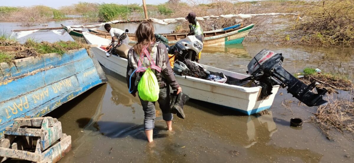
While I feel very lucky to not experience any cramps or other menstruation symptoms this time round, I nearly forget that I need a toilet before the second half of the day, esp the boat ride. After that’s sorted in some family’s compound’s latrine, we move onwards to the boat. The boat guy turns out to be a broker and introduces us to another guy who’ll take us. We ride through sand, more sand and finally beach sand to the water.
A bunch of guys are ready to help us load our luggage and bikes on the boat. Djo rides his bike into the water next to the boat and stops in the middle of the crowd. I read from the group’s body language that something is not adding up.

The guys are asking for 2k! He tells them 500 bob. They load his bike on the boat and (an 8 seconds job) and walk back to deal with mine. I’m still draining fuel so they have to chill. I don’t know why they decide to have the conversation in Swahili but Lowarengak being a cosmopolitan place they might not share a language. The 5 dudes debate why this guy with the white person only gives them 100 bob each. I realize that the mama with the many kids wouldn’t get any cash if this is their maths. She speaks no Swahili and has no phone so I can’t mpesa her anything. We finally find a loose 100 to tip her. A key learning for this kind of trip is to carry lots of small change. Or large cash of course.

It’s 3:20pm by the time my bike is on the boat. Turns out the captain is actually the turn boy and the captain himself is another guy. I chat them up to pass time and to raise my levels of confidence in the success of our journey. Between 2-3 hours is the promised crossing time and I’m getting mentally ready for another sand ride in darkness.
Before we lose network signal I let some fellow riders know where we are and what we’re about to do. Sitting in their Nairobi offices, they seem highly confident in the safety of our endeavours. My friend later tells me she started dreaming of sending choppers and bikers to the rescue. Pole for the palpitations but bless you always, N!
The lake is around 35km wide here and we’re moving between 10-15km/h depending on the waves. It feels painfully slow, especially considering I have to sit in the middle of my bench. The moment I lean to the right, the propeller doesn’t shika the water well, and I’m told “Sasa imekataa, kaa kati kati”. There’s no network for most part of the lake crossing so I get into some meditative state while keeping my eyes on the horizon to avoid sea sickness.

By 5:30pm we are 1km off the land on the other side according to Maps and 2km according to my visual estimation. The lake’s water level has risen so much that we’re riding the boat “on land” (Maps satellite images are heavily outdated!) for quite some time. The captain has a hard time finding a landing spot and we ride northwards along the shore for a few more kms to find a spot to reach land safely.


Finally, the two jump off the boat and pull us to land.
Our phones have switched to Ethiopian network, which is as +251 as our round the lake trip will get.
A bunch of friendly locals and curious kids await us. We don’t exactly have much cash left to tip, but the Marsabitians help offload our bikes either way. I exchange some pleasantries with the boat guys about arriving safely being more important than being on time. One day my government will ask me to surrender my passport.

We wade to the knees in smelly water with tons of dead fish scales floating and slip on muddy grounds. My jeans get soaked and Djo’s boots are full of water.

Finding a clean plastic vessel to pour the fuel back into Djo’s bike turns out a bit tricky, and by 6:45pm all we can think of is chasing sunlight on the remaining 10km down to Ileret through the sand.

But the universe loves us: The widest lagga has been fixed up with concrete and the road resembles a slightly sandy highway. Some corrugations, which we hit with 50-60, and on arrival in Ileret, Djo spots the illuminated cross of the Catholic Mission, which he suggests to follow. I really can’t see any cross, but some teenagers point us to the kanisa and a minute later we actually reach the mission. We greet the priest who just walks into the compound from evening mass. “Hi! Are you Fr. Benedict? (Yes). Can I ask you a crazy question? (mmmhhhh, okay?) Did you just switch off the cross?”
We all laugh heartily about the cross lighting our way but disappearing midway and me doubting Djo’s sanity (I never saw the cross!). The priest shows us a few camping spots and we choose the one on the hill top, pitch our tents and scavenge the left-overs from the dinner of some cheerful NGO workers who are in town. We would have cooked (noodles!!) but instead devour ugali cabbage. The shower is heavenly and we get to charge our devices on solar and let everyone know we made it alright to Ileret!
Day 6 done: 55+ tarmac, 50k offroad and 40km water
We’re halfway through our trip. Some incredible memories made!
Everyone’s healthy and no bike turned submarine. Team vybes are strong so far and our humour and patience sort out the little occurrences along the journey. The intimidation of riding with Kitui Djothefu has reduced, despite the fact that he’s keeping his shit together way too well while I keep dropping the bike. My bike’s mechanical issues give him something to use his brain power on, which I believe he’s secretly happy about (who rides for 6 days without music??).
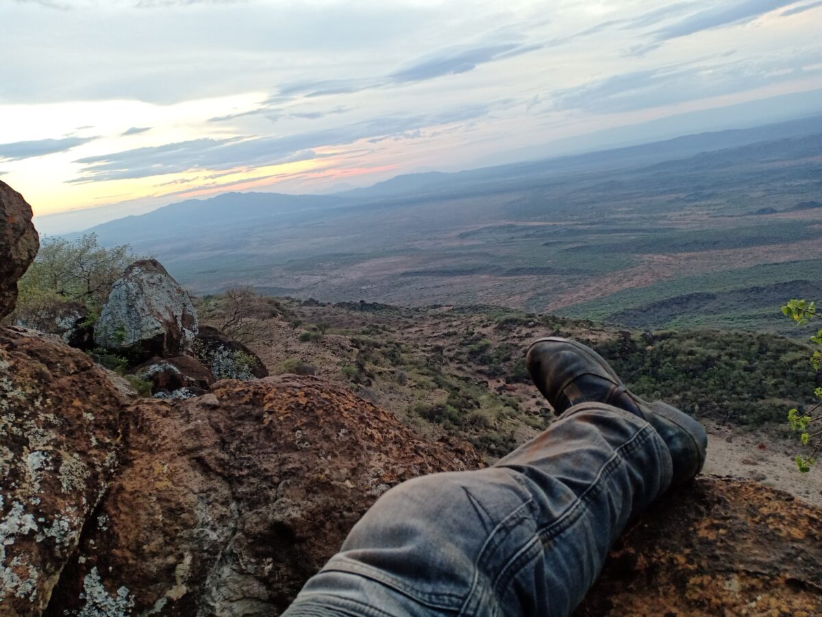
Our route plan has two more day stages to Loiyangalani (which is just as good as home!). That night I bathe in the feeling of accomplishment and success!

Are you having fun reading this? It’s hard to write about a 12-day trip! Maybe this should have been a book instead!?
Short break before we go to part 2: Some key logistics & ride preps
Y’all have asked me questions about my experience planning for the logistics of such a ride. Here you go:
Safety Gear?
1. I swear by my mesh jacket up here. It’s 35°C and you’re riding off-road meaning you’re highly physically engaged while riding. Sometimes you move at 10 km/h with no breeze, and sometimes you stand in the sun figuring out your next steps for a few minutes.
2. Boots: Off-Road boots would be much more ideal to protect feet, ankles and shins. My riding boots are armoured and high but in comparison to offroad boots leave 2 areas of my legs exposed to risk: If a foot gets stuck between rocks or twigs while riding the ankle may twist or break. The footpegs can causes bruises on the calves.
3. Knees and thighs: My riding jeans is two sizes up and therefore airy enough to not sweat. Just the thought of wearing those velcro knee guards or tight jeans makes me sweat. You could also get mesh pants (Check at Gear Hub on Likoni Road!). I fell on my side a few times, collecting bruises on the side of the knee (where the knee padding does not reach). So that’s my next thing to figure out. I will also endevour to have as little as possible luggage on my body in case of falls. The hip bag got the memo and said goodbye before my first unintended dismount.
Luggage?
Knowing what to carry and what is useless is the first step. Finding the right bag solution to carry your stuff is the second, equally important step.
Basically, with these vibrations, everything will fall and tear and break. The dirt, sand and dust will penetrate all fabric and zips.
I follow Kinga’s advice and put all my luggage including the tent and mattress into one large speed bag (a basic, dirt cheap 75l canvas bag with a roll-down closure from Germany). Good idea because the tent bag would have torn completely on these roads if I had carried it separately. I tie the speed bag down symmetrically with two (EU normed) straps with metal buckles and then fixate them further with bungee cords. After the first bumpy kilometer of a day my items would have moved around a little inside my bag and then I stop to lash the bag down again more tightly. It works pretty well after I figure it out on Day 3 or so! I love that I only have one item to watch in my mirrors. Sorry, mirror singular. Muuuuch better than losing my contact lenses because of a torn backpack zip in Eliye last year…
Only disadvantage is that my tools are inside the bag – making them hard to access during the day. They would be more ideally placed in a tank bag.
I also had a very light backpack for my water, snacks, first aid kit and power bank.
Djo has a cool saddlebag combination from Red Mamut, allowing him to store his clothes separately from the kitchen and camping equipment. It also has separate pockets for first aid kit and tools. So where we don’t camp, he can just remove the bag with his clothes and has an easier time packing in the morning than I do – my bag needs packing from scratch every single day.
Bike love?
A 1,300km rough off-road ride is not a joke on any bike.
Carrying tools, yes, sure. But do we even know if we really have all the tools for our bikes? Does that spanner which I have actually fit between that awkward plastic and metal to tighten that nut?
Check bearings, fork, suspensions and seals – and don’t be afraid to replace things before departure. Consistent use of thread lock or even use of lock nuts in crucial spots would have been really ideal (giving myself a side eye for this oversight) and saves you time on a daily bolt check. Carrying extra spark plugs and throttle/clutch cables is key. We had a full puncture repair kit incl. pump and tire levers. And the nail polish.
Medical side of things?
How’s your nutrition and fitness generally? I don’t mean lifting weights but having endurance for many 12-hour days in a row. While on the road, staying hydrated is a major strategy to safe riding. If you’re not peeing, take 10 minutes and finish a whole bottle of water, please. Start and finish your day with an extra litre. A few sachets of ORS are standard. First aid kit and skills (!) are a must. We didn’t plan to need to remove ticks from our bodies, but indeed the 1st aid kit had tweezers. An air evacuation cover is obviously ideal and rather affordable.
Knowing the route and directions?
20km up here can take 2 hours as we impressively proved enroute to Lokitaung. We used several apps with different map material to piece together our route before departure (MapsMe, Gaia and Google Maps Satellite view). In addition, we always confirmed on the ground whenever possible, even the most basic information about the terrain, road, distance, weather, safety etc. As expected, the more relevant intel comes from local riders, not people who use cars. We got it wrong a few times. Gathering info from other riders is also helpful, as panya routes exist that are not on Maps.
Excited to find out what went down on the remaining half of the trip?
Continue with Part 2 here (link) for the deets on the Marsabit and Samburu adventures with some incredible moments with 6 million year old fossils, riding through Sibiloi National Park, advanced mechanical challenges and some bone-shattering night rides!