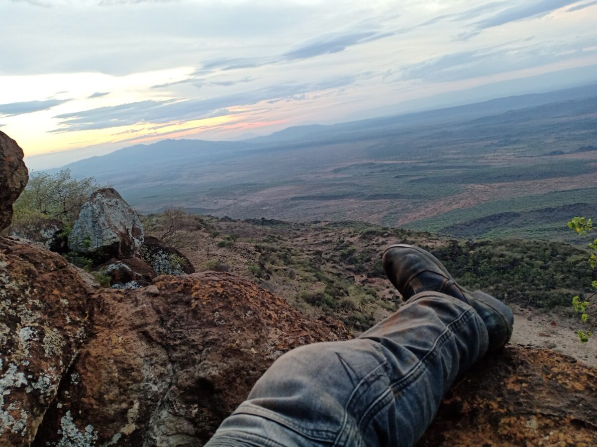
I wake up in my tent to birds chirping. I open the zip to soak in the views towards Lake Turkana from the hilltop at the Catholic Mission. It’s taking my breath. Time stands still in this place. It’s as if the soul synchronizes with the ancestors who strolled around this place a million years ago. It’s equally peaceful and volatile. So much water, yet none to drink. No rains for the last 11 months.

Part of me longs to stay for a week and get lost here. But the toughest riding through Marsabit is still ahead. I snap back into reality. This is not a solo ride after all.
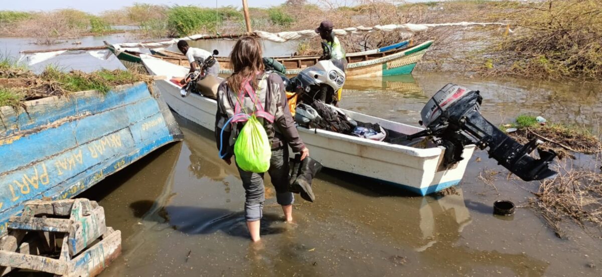
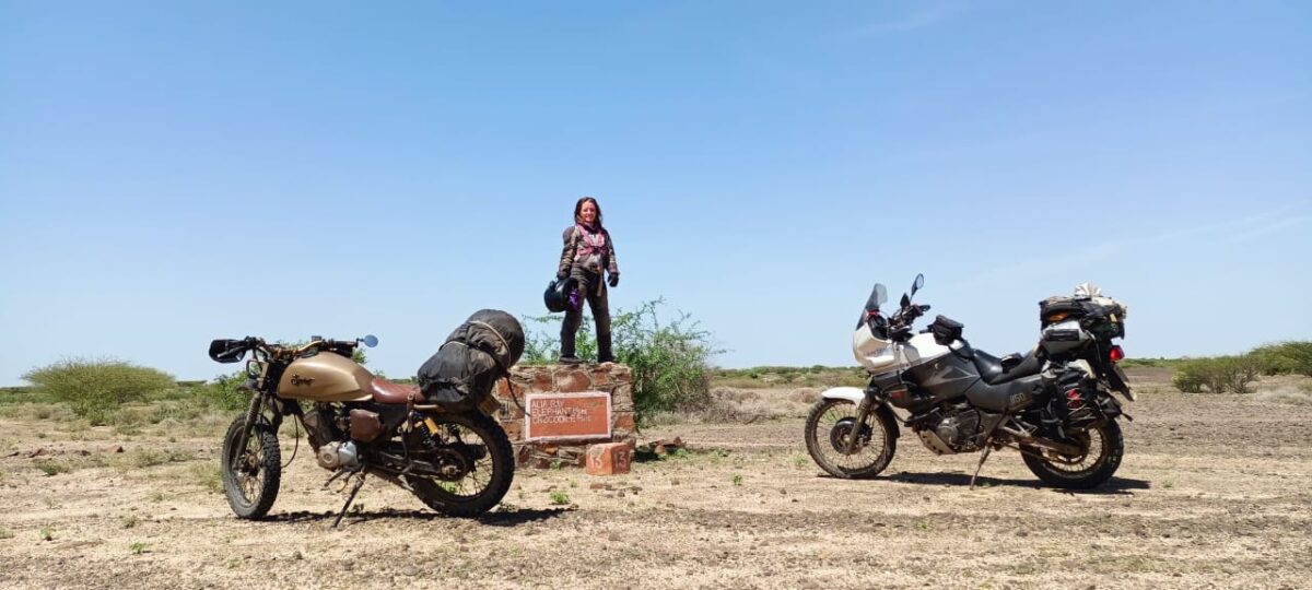
Djo waves his Good Morning from near his bike. Wow. We rode 1,000 beautiful and eventful kilometres spread over 6 hot and long days from Nairobi towards the Ethiopian border through Pokot and Turkana. We missed exploring the Ilemi triangle but arrived safely on the Marsabit side via boat last evening – our phones on Ethiopian network on arrival.
An incredible adventure. If you missed part 1 of the story, here’s the link.
We take a recovery and exploration day in Ileret before starting the journey southwards back to Nairobi.
Day 7 – Tourism Day in Ileret
Have you looked for Ileret on the map already?
Let me tell you something.
THIS PLACE IS REMOTE!!! It’s constantly drought struck. The majority of people around here live a nomadic lifestyle and culture. Nothing grows here that most of us would call a plant. Cattle really matter and livestock conflict occurs from time to time. Three days before our arrival the area made headlines on national TV with thousands of livestock dead from drought. Google Maps will not show you a road here. Even using satellite view you will not find one easily.
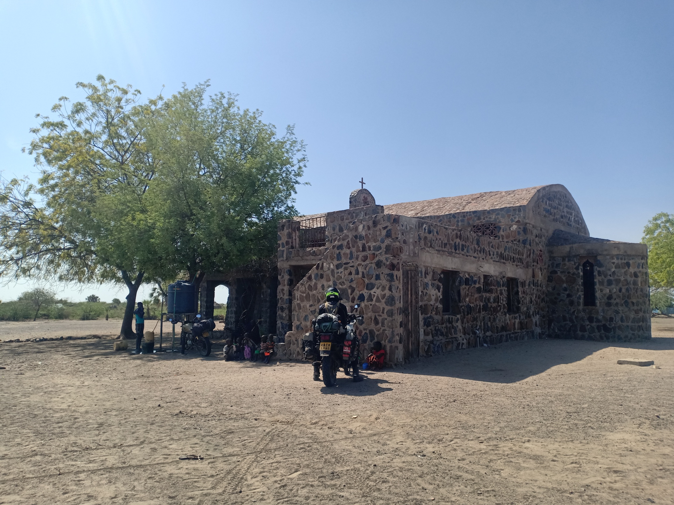
Wakili and I have spent hours discussing riding to this place. I have met Father Florian, a German priest and Benedictine monk who has been up here since 2002, to learn about the mission’s work. After coming to Ileret, I agree with his words “To support the people of Ileret, you have to come here and live with them”. He’s not a fan of one-off charity.
The Turkana Basin Institute has an office here and one of their employees approached us at Women Bikers’ Association-K some time ago to arrange a girls mentorship initiative in Ileret for lady bikers. She’s been a friend of WBA since then and I was thrilled that I made it to Ileret and might see their community engagement work. Sadly, Richard Leakey and a senior TBI leader just passed on recently; and so she wasn’t around Ileret, but she took care of us via whatsapp and arranged our visit to TBI.
We are happy to not touch the bikes for a day, and get a lift in the mission’s car.

After a warm welcome by the TBI team, we get a tour of a GIZ funded hydroponics project. Skuma wiki and tomatoes in this dry and hot desert! Listening to the agronomist in charge, it sounds like research. He’s very experienced in hydroponic farming (a horticulture technique that grows plants in a nutritious solution instead of soil, and minimises water use) in other parts of Kenya, but mentions that here he started from zero, as the day’s heat and night’s cold interfere with minerals and pH value, thus the entire planting system.

The project aims to test out and establish hydroponic farming in this geography while training and engaging the local population to set up green houses and hydroponic systems near their homes in collectives. A whole water desalination machine is part of the project and water will be pumped around the place widely, because the half a dozen wells that were drilled all came out salty.
We’ve heard of so many failed agriculture projects on this trip that I’m thinking of coming back later this year to check on the progress 😉 Here’s a link to read more: https://www.turkanabasin.org/2020/09/hydroponic-gardening-at-tbi/
The main work of TBI of course is in paleontology, archeology and geology (yeah!). We are very lucky to have the Assistant Curator take his time to run us through the archaeological process and we get to see some fossils upclose.
We’re not allowed to take pictures, so you can either ride up there to see it for yourself or work with my descriptions 😀
First we start in the arrival room, where the fossils arrive from the field. They are covered in plasters that protect them on the bumpy truck journey. The items we see in this room are 1.5m to 4m years old. To estimate the age, geologists join the effort and take soil samples near where the fossil was found.
Then the fossil has to be cleaned up carefully, which could take 6 years for an elephant for example.
We see huuuuge elephant tusks and a massive crocodile head. They are at least three times size of these animals today. It’s astonishing. We’re told that the area was a huuuge forest in the past, very green with nutritious food, meaning the animals were healthier and larger than today.
Standing next to a 2 million year old elephant skull makes me feel that we humans really are just a passing drop in the ocean. I feel so furious that for the last 150 years humans have felt entitled to hunt them down to near extinction.
Next we walk over to the collection room. There is a huge documentation effort going into this: A field number is assigned, documentation of where it was found, photos, soil samples, etc. There are currently 27,000 fossils in the collection which is under the National Museum of Kenya. It’s all extremely fascinating, but what sticks most with me is the patience and dedication needed in this field of work.

We chill at the mission most of the afternoon enjoying the views.

In the evening we look for fuel to make sure we hit the wilderness awaiting us with full tanks. We get fuel in bottles at 200 bob. We’re later told it’s Ethiopian fuel which is said to have lower quality. We shall find out, won’t we?

Around sunset I spot a scorpion just outside my tent. I know NOTHING about scorpions, and I’m told they attack easily and are poisonous but not deadly. To imagine that last night I went to pee a few times in my slippers 😱
No, there is no picture of the scorpion. Just google it, it was one of the orange East African species.
Day 8 – Ileret to Koobi Fora
In the morning, Djo finds another scorpion under his tent. We pack up carefully and say goodbye to everyone at the mission, then pass TBI for a photo.

Today’s a short but sandy day. Around 60 or 70km to the Koobi Fora base camp, partly through Sibiloi National Park. The road from Ileret to Loiyangalani is not on Google Maps, and because satellite view doesn’t work without internet, I had traced it on satellite view and pinned it down with a million stars. Talking of needing some certainty.


After a quick 10km on sand roads and a warm-up bike drop, the road changes to pebbly tire tracks. The rest day pays off and I am finally getting faster at this. So fast that I miss the turn to Sibiloi. At some point I feel as if we’re going in the wrong direction. Maps and Maps.me both confirm that we have to backtrack 3 or 4km.

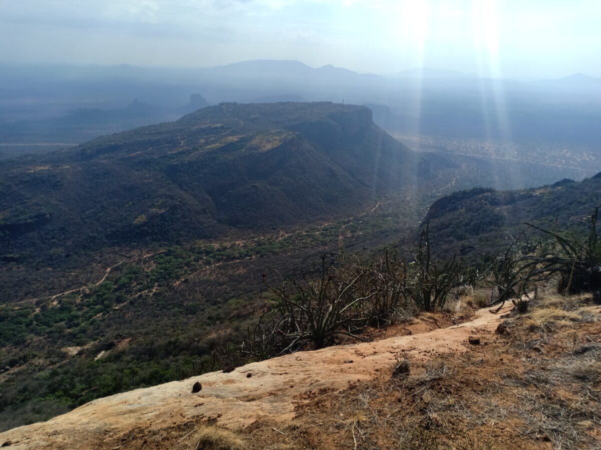
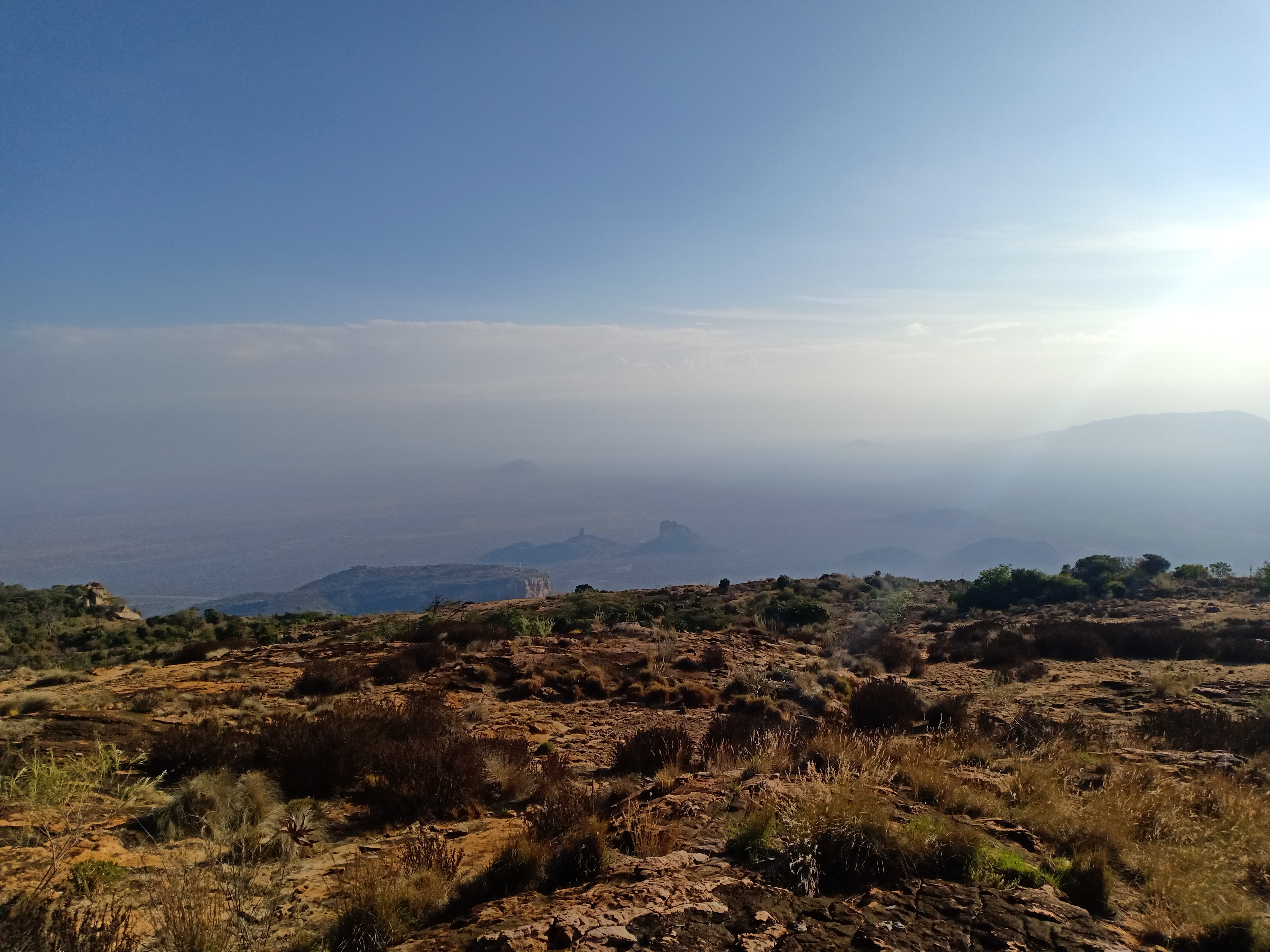
We find the sign to enter Sibiloi National Park, which to our defence is slightly hidden. The rest of this day is best told in photos.
Enjoy!


At some point the river becomes the road. It’s silly sand for a kilometer or so. I’m not doing badly and Djo disappears behind me. When the sand ends, I wait for a minute or two, enjoying the incredible silence up here and drinking water. But he’s not showing up in my mirror. I just know that he dropped the bike. Finally. A part of me is relieved that I’m not riding with some sort of super human. I remove my gear and shout his name. Nothing. I really don’t feel like riding back so I walk back to look for him. By the time I get to his bike, he has lifted it and is loading his luggage (which he had to remove to lift the bike).
We’re extremely close to the camp, but the sand is beach deep now. Want to suffer with us for the last 1.5km (11 minutes) to Koobi Fora base camp?
Knock yourself out with this helmet cam video (link)!

On arrival, we chat with the team and are informed that we’re very lucky because there is indeed rain water to drink. I nearly faint, but am told that everyone drinks it here. I relax my mind telling myself that the tank just holds water and dust, but you can never be too sure what bacteria are breeding in there.
My amazing flatmate Marg brought some chlorine tablets from Chicago in 2015, which have since long expired but I had popped a bunch in my luggage. I prepare 2 litres of water for my mzungu stomach.
At some point Djo confesses that he leaned the bike against a wall and needs help to get it out from there. At this point I don’t yet fully grasp the situation and lightheartedly offer to help.
Y’ALL! I find a huge heavy bike dug into a hole of deep sand between a wall and two wooden pillars. We try pull, push, lean, use stones, pull it lying on the ground. No progress whatsoever until we get help from staff. My biceps, again. But this makes up for at least 6 of my bike drops so I feel redeemed.

The beach is so inviting for a swim. It feels like the perfect spot but I have mad respect for crocodiles so I have a bikini tanning session at the shore instead. Possibly paradise!

Before sunset we also engage in a bit of bike care and use the nail polish to tighten a bunch of bolts on my bike. Comedy but I’m taking notes!


We make noodles and githeri for dinner. The tinned food is really coming in handy.
Let’s face it: my noodles by now are just wheat powder. But Djo is a pro and had packaged his for off-road survival.

I do a micro yoga back stretch session while watching the stars lying on top of a wall. After the encounters with scorpions in Ileret I keep my boots on all night.
Today we covered around 100km on rough and sand roads!
Day 9 – Koobi Fora to Loiyangalani
Highly ambitious, we had decided to go to Loiyangalani directly from here. So it’s going to be a long day. We’re not exactly sure where next we will get drinking water, so we fill up all the canisters and bottles from the rain water tank.
To get to Loiyangalani, we have two routes in mind: via Moite or the more visible car road which I traced on Maps, from which we would join the North Horr – Loiya road around Gas town.
Either way we have to cross Sibiloi National Park and get to Karsa Gate first.
After paying our 200 for camping to the museum ticket agent, we backtrack to the air strip in around 45 min, which is maybe half of yesterday’s time. Engines are getting hooot as we carefully manoeuvre the 8 or so kms of deep and shallow sand.

At 9:16am we turn right at Parkmarker 14 and have another 45 km of Sibiloi ahead of us. We estimate 4 hours to the gate with breaks.


It’s pretty wild as we travel on a hardly used road. There are gravelly uphills where I get stuck on huge rocks that you then remove from under your bike while somehow still sitting on it. First gear holds the bike, at least I’ve figured that part out by now. Lots to learn and laugh. Overall looooots of fun.
Sometimes the terrain is that wild that the only road option is the river. It must have been crazy muddy here a few days ago! We find it completely dried up 💃🏿


Another river crossing. And another one. Not the white sand but it’s darker now. At some point the (sandy) river is the road, then you cross a rocky riverbed, and a bit later you follow a rocky river as the road. It’s chaos.
We later find a video on facebook showing a landcruiser driving on this road through 1m deep water. Bonkers 🤣


What goes up must go down, so there’s that one gravelly descent down a mini escarpment. I try the 2nd gear engine break technique, but freak out half way through when bigger rocks show up. 1st gear would have been smarter. Still more practice needed!
The petrified forest fossil site is just before the gate. The quick 6km detour is worth it. We pass some colourful stones and pebbles and get to the petrified trees and wood stumps.


When it’s just a few kms left, is when you get to a final massive river crossing.


We each get through 2l of water before even getting to the gate. We pay our park fees and have a quick lunch. It’s super windy here. At 2:40pm we gear up for departure. It is 120km to Loiya, so we need to hit a 30 km/h average to make it. We’ve not done this on any day this trip! The roads look pretty decent on maps satellite and we’re told a land cruiser would need 4 hours. This statement could have been cause for concern but we ignore it.

We fill up the water reserve tanks with more rain water at the gate and wet our t-shirts and Balaclavas for some cooling effect while riding. Djo is using the hack he got on AMD and cools his drinking water wrapped in a wet t-shirt from the ride’s airflow.
I don’t know what exactly I expected. But in my mind the road was going to be better starting from the gate 😉 It’s in a baaaad state and we take a good hour for the first 10km. Lots of deep holes, sand crossings and rocks and we just can’t get to a sensible speed. Basically, the gate is in the park, we conclude later.
Then it gets smooth and wide. But not for long. Gravel mixes in.
At some point we get to a KWS sign-post, which we were earlier told indicates the junction to Moite. Djo had raved about the road from Moite to Loiyangalani, but we just weren’t sure about the road to Moite from here. Only one person we asked knew about its state and they said it’s enough sand to get a 4×4 stuck. We decide not to find out and stick with the main road, however annoying and slow it is.
One of those moments you replay in your mind later.

We keep ploughing forward through changing terrain. We cross several riverbeds and pass at least one more areas where the river is the road. And sometimes you just can’t tell anymore where the river is. I don’t want to imagine this place with rain or floods!

Finally we get to a long sandy stretch, a few kilometers long. That beautiful evening light sets in and cattle cross the road. The first sign of human life since the park gate. I’m trying to make mile and I’m around 1km ahead of Djo when there’s a boda track leaving the road to the left. We’ve now learned that they tend to circumvent difficult stretches on the main road, but I also don’t want to get lost, so I stay on the main road.
I find a whole bunch of huge rocks on the road, and go down nearly at the end. Djo is nowhere to be found. No network. It’s 5:45pm. I try to lift the bike but have to remove the luggage first to succeed. It takes me some time to tie it back. Djo hasn’t caught up yet and I worry that he took the boda track and is now ahead of me. What a disaster: I imagine how he’s chasing me, yet I’m behind him. I send him a text with my GPS coordinates (that doesn’t actually go out for lack of network) and continue riding. By now it’s 100% clear that I won’t make it to Gas by sunset.
We are still around 80km from Loiyangalani and the terrain allows no speed. There are no signs of human life whatsoever: No livestock and no huts. We haven’t passed a single car since the park gate. I don’t have lights on the bike, so I decide that I would pitch my tent on the roadside wherever I will have reached at 6:45pm and continue with sunrise. I don’t feel unsafe at the thought but considering there is no network, my people including Djo would probably start freaking out if I’m not reachable at night in rural Marsabit.
Around 10 minutes later Djo shows up from behind. Relief!!!
He also fell (not far behind me it seems) and also had to remove his luggage 😅 Now who let who down?
We continue and reach a fairly wide and straight road. Djo keeps checking his GPX recording from a previous trip with Wakili. At some point we realize that we have deviated from their route, but are still on this wide main road, so it feels fine.
Another moment we will keep reviewing in our minds.
We miraculously cover another 15 clicks until we get to a junction pretty much at sunset. Should we take the right narrower road towards Gas or the wider one straight ahead towards North Horr?

We decide that we can as well sleep in Gas. The town has been described as relatively developed with a few shops. Covering 30k in darkness seems doable with a shared headlight.

Until the road turns into one deep tire track and we’re basically riding on large white stones in those tire tracks. The experience riding up the gorge to Lokitaung dwarfs in comparison. Everything is just loose, no hard surface below. Even if we get to a smoother stretch with smaller pebbles, it’s just 200m long before it goes back to the madness.
Djo’s light is super bright so at least we know what we’re doing. He rides in the left tire track and I ride in the right one. At some point we switch (so much work!!!), so that in case a fast landcruiser shoots along the road, I don’t get knocked. (No car comes, maybe this was our wishful thinking). I am making 8-10 km/h top speed, and just not getting to a smoother rolling 2nd gear. Maybe the bike is too light, doesn’t have enough power, or my tires are too small. But I’m also really worried of falling right now, so I’m probably really slow and look down too much. I’m sweating like crazy handling the bike at low speed on these rocks in first gear, constantly tapping my feet and having all this weight on my shoulders. This is not economical on our limited water supply at all.
We hardly make more than 500m before stopping to breathe and drink.
At least we have excellent 4G network here and check the satellite pics. The road we’re on shines bright white on the images while the surroundings are dark brown for the next 15km or so. We interpret this as the entire stretch being this messy.
We keep going and manage a good 10km (in 80 minutes), but the stops become more frequent. My pants are rubbing my thighs sore along the seat’s edges because I’m walking more than riding. I’m fairly exhausted by now. At one of our stops, Djo checks his GPX and realises that we’re near a boda track and he suggests we leave this road and use the boda track. It sounds equally tempting and nuts. As we debate the idea, his bike battery goes flat. Flat as in his lights go off and the starter is not working. With both bikes not having lights, we’re basically standing in complete darkness in the middle of nowhere.

I climb off my bike and light my phone torch to explore the surroundings. Going really slow for an hour with the bright LEDs has drained his bike’s battery. We’re still stuck in the tire tracks with stones. It seems impossible to pushstart him here, even if I wanted to try, which I don’t.
We debate our options (none) and decide to pitch camp. Djo is not sold but my logic is that the faster we sleep, the earlier we can wake up and figure out our next steps with some daylight. We push the bikes like 5 metres to the side of the road and then pitch the tents in torch light, looking carefully for scorpions (none!), then I sit on my bike to snack musli bars and tinned pineapple while Djo cooks his dinner.
It’s 21:36 when I inform my crew in Nairobi of my situation. A part of the crew, rather. I have to give it up for each of these guys. Always supportive, checking in, and dishing out encouragement and jokes. The type of people who agree to be your emergency contact on such a trip. Who pick your phone call at odd hours – after taking a deep breath of course.

I prepare the final 1 litre of rain water we have left from the park gate with a chlorine tablet. This will have to get us to Gas, which by the map is just 12-15km away. What a nightmare thought to contract a water borne disease up here!
We have a short discussion on safety. Don’t ask how this went, cause tell me what measures exactly you’d take that you’d find sufficient?
My GPX recording says that we did around 150km today. No tarmac, for those who weren’t quite sure.
Day 10 – Middle of Nowhere to Loiyangalani
I wake up to motorbike sounds at around 1am. It’s quite surreal: I can hear it for a few minutes at equal volume, then it passes outside the tent and immediately can’t be heard. The wind is that strong. This is also the first vehicle since the park gate.
I fall asleep again and wake up at 6am. I start packing my stuff in my phone’s torch light.
We have a bike to start and want to make the best of the early sunrays before it gets hot!

Looking around, I wonder if we are mad or lucky. Or both. Kilometres of Mars like surface with no houses whatsoever.
What was the rider thinking that passed our tents and bikes at 1am? And where on earth was he coming from and going?

Have you ever jump started a 220kg bike on rock dust? Well, I invite you to try but this morning it was not working for us. We try different locations, with me pushing as Djo duck runs the Super Tenere. The bike skids and the back tire just digs up the gravel, whether in 2nd, 3rd or 4th gear. It’s just past 7am and I’m already sweating!
At last, a landrover drives by and stops to give us a full bottle of water. These angels were on a family visit to a nearby homestead!
Plan B: We can charge his bike from my battery! Getting to my battery means removing the tank. We lever up a messed bolt and connect the two with some wires and spanners. Just as we’re realising that his bike can’t start directly from my battery but would need slow charging, a bike passes with a passenger and a goat. They offer to help push the bike “sasa tuko wengi”, they comment looking at my biceps, but achieve the same result.


Back to connecting the two bikes and slowly charging up the Tenere while running my engine. We thank the two gentlemen for their help and they point us to the boda track as an Eastern Bypass for the horrible road, also passing through a village with fuel. Yes!

As we try to increase the idle on my bike to keep it running, somehow my bike goes off. It’s all one beautiful mess! After playing around with the choke and idle and finally syphoning some fuel from the Tenere, my bike starts again (on the kick).
In total we need over 2 hours to get moving but at 9:30am we enter the boda track. It’s smooth but really narrow and quite the random route over hills and between bushes. The local riders are ninjas!


We arrive in a small village called Barambate.

We each top up 1.5 liters of fuel from the barrels in a lady’s hut, which we think should be enough to get us to Gas. The boda track is far longer than the bumpy road would have been but fairly smooth.


By 11am we enter Gas town – but what an underwhelming sight the place is. A group of colourfully clothed women is busy constructing a hut, but otherwise I mostly remember garbage and plastic. A local rider offers to help us find fuel and water. I’m really uncomfortable following him around, as he randomly passes between peoples’ houses and swerves around.

He’s taking us to 3 different stores, but hakuna petroli. A car convoy has picked up all fuel yesterday we’re told. How did we ignore rule 1 in Barambate? Sigh!
At least we buy water and fill up all bottles and canisters. We estimate what’s left in our reserve tanks and find that we should have enough fuel to cover the remaining 40km to Loiyangalani and turn down his offer to ride back to the other village to bring us fuel.
We end up at his house and his wife offers us ugali cabbage and and some real good masala chai.

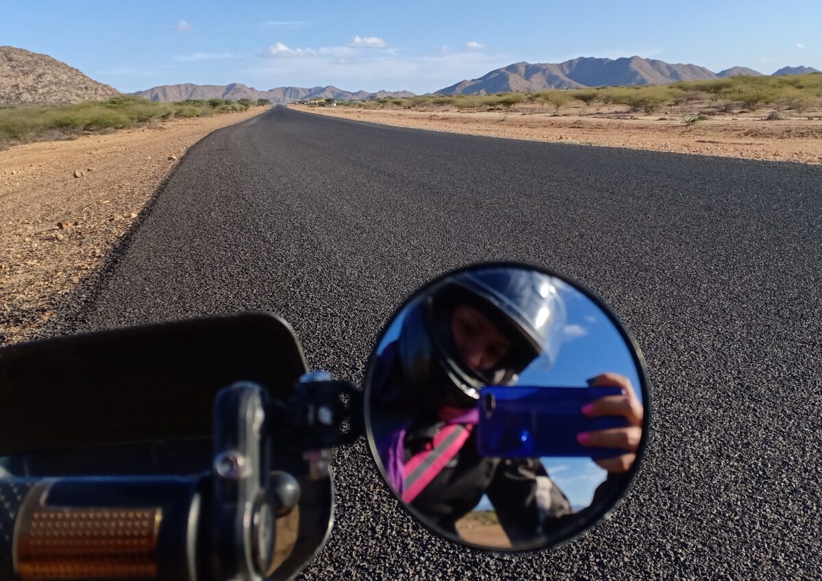
By 2 we’re on the road from Gas to Loiya. There is nothing beautiful or enjoyable about the first 25km of this road. It’s heavily corrugated. You really feel for the bike. It’s pretty windy. Gravelly. Hot.
But worst of all: My steering seems stuck on “straight”, I’m running on rails and nearly fall a few times. I’m having a really hard time steering into the wind and into the corners smoothly. I am not thaaaat tired! What’s going on?

I catch up with Djo who’s taking pics on the concrete and I tell him something is wrong with my bike, especially on the corrugations. He mentions also having a hard time after the smooth tracks, so we keep going. After I nearly fall on that same concrete stretch in a corner, he considers to believe me and we stop again to diagnose my steering. It just doesn’t turn smoothly. Seems that the bearings are shot. This is of course a gradual process but the last 500km probably didn’t help matters. But there is nothing we can do right here.
We have to get to Loiyangalani.

I don’t know how I manage the next 30km, but the beautiful views around El Molo and Layeni certainly help. Beautiful Jade Sea!

I have not entered Loiya from the North before, but remember that small junction from my last visit.
We head to Palm Shade Guesthouse. The team tells us they expected us last night. We nod but can’t explain ourselves. But my shower is heavenly!
Local riders point us to the one fundi in town but he’s not in as it’s Sunday. We talk to him on the phone and on naming the bike’s model, he seems optimistic that we can source a set of steering bearings early on Monday. He promises to meet us at 7am.
We have an early dinner and I’m already stretched out in bed when the lights go off later this evening as the generator is switched off.
70km done today and some serious workout pushing the bikes around in the heat 💪
Day 11 – Loiya to Maralal
We have to get to Maralal. There’s really no option. Sleeping in Baragoi doesn’t excite any of us based on our earlier experiences there.
This is 240km of rough roads and our estimate is 8.5 hours including 2 breaks.
We agree that if my bike wasn’t fixed by 9:30am, Djo would leave me in Loiya and proceed as he has some work commitments in Nairobi coming up.
At 7am we call the fundi who promises to arrive within the next 15 minutes, which he does. Turning my steering with the bike on the centre stand, we all agree that we have to replace the bearings. We ride to his workshop and he actually succeeds in sourcing the spare part. The guys take off the front wheel and I watch him knock out the old bearings (the plastic that holds the metal balls had completely disintegrated) and chisel in the new set, while Mr. Djo IY handles the quality control of the entire surgery. Paul does a really good job – highly recommend him.


By 9:04am I test the bike and find it running smoothly. We pay Paul and head to the hotel for breakfast and packing up.
By 10:45 we head out from Loiyangalani – 240km offroad loading! We both know the route well and it feels like the home-run.
I’m most excited about the stretch from South Horr to Baragoi as I remember it being very beautiful from my last trip (link). Back then we didn’t stop for pictures because we were warned not to (bandits). Also, the metal holding my suspension had broken off, so it wasn’t a very comfortable ride.
On leaving Loiya southwards we find the road heavily corrugated. It seems that there are more trucks nowadays and we even find a bus (!). The 30km to the wind farm are quite bumpy and not exactly fun this time round. I also nearly get knocked by a lorry.


The wind is strong but mostly coming from one direction, so manageable. Once up at the wind farm, we stop to check on Djo’s exhaust, which has slightly moved from all the bumpiness.
This is the last time we see his entire toolkit. We later find that the metal holder of the tube holding the tools broke… These vibrations!! Makes you appreciate the physiology of your spine quite a bit! This must be the most painful loss of this entire trip. 😭

From here it’s a quick ride on the windfarm road to South Horr. After the wind farm road branches off the left there’s more sand, as we ride through the beautiful South Horr mountain range. We roll into town and stop at the shopping center, where I buy water and one of the fundis who fixed my suspension (and footpeg 😌) last year says hi, remembering every single GS he saw.

On leaving South Horr we stop for pics between the trees, and a local guy ferrying two kids turns his head just a little bit too far, just a little bit too long, and drops his bike.

From here it’s a quick 40km to Baragoi. It’s very scenic but we’re trying to pick up speed where the sand allows.

As we roll into Baragoi, most shops are closed, but my lunch spot is open. It’s already 4pm as we park at Mashallah Restaurant. The lady hugs me as she recognizes me and enquires how my friends are doing. We have some really tasty pilau, chicken, kachumbari and masala tea.
And off we go entering the final 100km for the day. We aim to finish the corrugations fast and enter the mountains leading to Maralal before it gets late. We stop at the Barsaloi junction, where there’s a sign with bullet holes by the Catholic church advertising Barsaloi as the cleanest town in Samburu (go check if you don’t believe me!) – it’s already 5pm so we have no time for experiments, but I take a mental note to try this route another time.

I start panicking as I realise that they dug up the road in an attempt to widen it. I remember a relatively smooth track through the mountain range, but now it’s rather bumpy with big rocks and holes. Or was it the rain? It probably also feels more difficult than last time because we’re gaining 700m altitude and I don’t get enough power to fly up the rocky climbs.

Either way: I’m slower than I like. Soon enough, the sun sets over the dramatic Samburu hills.

By 7pm we’re near Suyani, around 40km to Maralal. Djo and I think about our options. We aren’t feeling the idea of sleeping here and decide to get to Maralal on a shared headlight. It feels safe to continue with the wider road and slightly more traffic than we remember from last year.
There are some dark clouds building up over the mountains and this area is chilly at night. We stop to wear rain gear over our mesh jackets.
Darkness. Now we get a bit wild. Djo is riding directly behind me and around 1-2m to my right. There’s no room to swerve, so we basically just gas through the mountains. We’re doing 30-55 on the bumpy rough road and I’m doing some of it standing for better visibility. It takes some synchronising and skill to ride on one headlight! On uphills or corners I’m basically riding with zero visibility for an instance until his light catches up. It feels thrilling and I let go, setting a decent pace.
At some point what looks like a gentle bump turns out to be a ramp over a deep ditch. We can’t even see the bottom of it. My bike takes off and we’re just lucky that I was doing good speeds, otherwise it could have been a nasty fall.
At 8:30pm I text my people that we’ve arrived safely. We find the fuel stations closed and look for a simple hotel and restaurant in town.
Day 12 – Maralal to Nairobi
Noone’s looking forward to these last 330km. Tarmac. Kenyan drivers. Nairobi air and noise.
So we fuel up chap chap and hit the road to Nyahururu. It turns out that the entire Kisima stretch has been tarmacked since I was here last, and only a few kms are missing to close the tarmac all the way to Maralal.

153 clicks to Nyahururu where we fuel at Shell. I have to slap Djo as he is nearly dozing off from the tarmac boredom – it’s extremely understimulating after an adventure ride.
We get lunch in Ol’ Kalou and continue via the Aberdares route through Engineer and connect to the Naivasha Highway from Njabini. I am always nervous about the Soko Mjinga stretch to Limuru, moreso without headlights but Djo leads, fighting off oncoming traffic with his many lights, and we find the highway not as busy. At the Gitaru traffic, I lane split between a bunch of police pick-up trucks, who are returning from some activity out of town. One of those annoyingly hyper white baby trucks cuts off two of the police trucks and gets reprimanded. I nearly fall off my bike laughing, but instead turn left to the Western Bypass and reach home in under 20 minutes.
HOME! I stop at my mama mboga and source a huge bag of mixed greens. After all the noodles and cabbage! My askari asks me whether this is when I’m back after all these many days. 👀

It turns out that my house key was in that hip bag. My good friend who keeps my spare key makes it across town to save me from camping in my own parking lot.
After the ride is before the ride
There’s the washing to do, and the bike repair to think through. There are limbs to rest, and bruises to admire. There’s the GPX route recording to analyse and laugh about. A million photos to review: two phones and two helmet cams. It’s amazing to relive some of the scenery and hilarious encounters on the road.
Over the next days, Djo drip feeds me with photos of my unintended dismounts until my phone’s memory jams.


And mech training. Laughing through the curve balls. Dinner conversations and friendship. Mungu akubariki!
As the trip replays in my head, I randomly break out in laughter throughout my day. It feels sooooo good. I come up with the many routes I still want to try out. I plan for my dirt bike training. And I realize that traveling on the bike for weeks and months doesn’t sound such an impossibility anymore!
At Bikers’ Prayer Day I realize just how many bikers had followed our trip via Djo’s posts on AMD and my insta page. I answer many curious questions about the trip. I also realize how few people know that Turkana is not Marsabit and that there are ways to get to Lodwar that don’t involve tarmac. If only half of you go out there and go a bit wild for a few days, I’ll be very happy!

My biker pal predicted that I will need a week to recover. I trust him, he’s a doctor 😅. That week ends today. I am still in that meditative high, that flow state. But I am also still exhausted! Nairobi noise and air pollution don’t help.
Now, there’s this badass somewhere at the beach, my partner in crime, my re-invention muse and my business ally. She understands life with a rare intensity.
Martha penned down exactly what the trip felt like so I’ll just close this with her poem. Don’t miss to buy her book!
Head over to Djo’s site and read his story about this trip in 4 parts. Incredible photography and artsy writing.