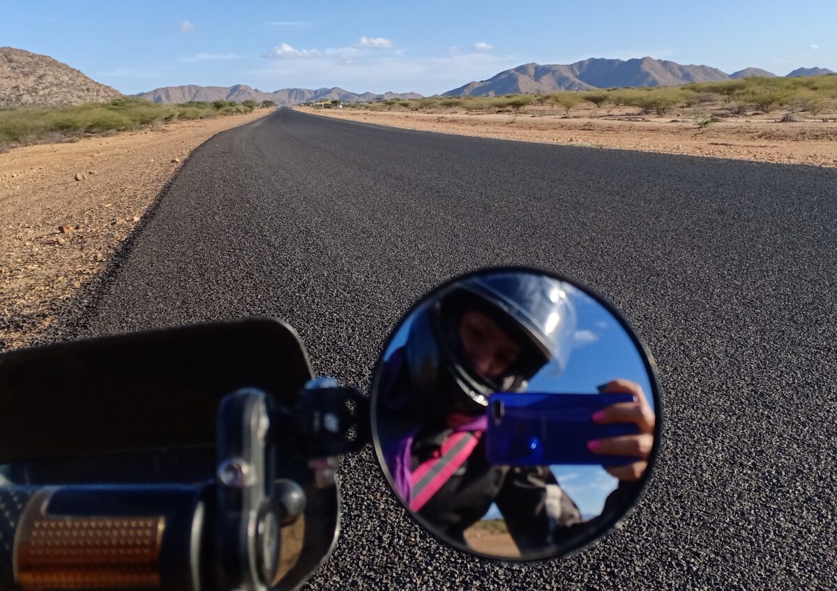
In all these years I’ve never been to Northern Kenya. The idea of watching the sunset by the beach along Lake Turkana and riding through desert is so enticing! Between Turkana and Marsabit I decide to do the former, hoping it’s the easier and safer choice for a solo trip.
I ride a small engine bike, a Spirit built on a Honda 125cc engine and with around 8,000km experience consider myself an advanced beginner. I wasn’t sure if I can do both, Lake Turkana and the border to South Sudan in 10 days, but I was going to take the decision once up North.
It became an eye-opening 11-day trip on less than 35k including food and bike service. After great responses and many questions on my Instagram posts, I decided to pen down the details for those curious to try out Northwestern Kenya!

Day 1 – Nairobi to Lake Baringo – 278km
I set off towards Nakuru via the Mai Mahiu route. There’s a curio shop with a rooftop terrace and toilet called 8th world wonder. I can chill there all day, but I move on quite swiftly after devouring the breakfast snack I carried.

After lunch in Nakuru, it is 1.5 hours beautiful riding on good tarmac towards Kampi ya Samaki. There are random deep (!) potholes so don’t daydream as you might find yourself in the ditch. I stop for the mandatory equator pics in Mogotio.

Last Shell is in Marigat and I fill up to the brim!
If you arrived early or had an extra day, you could take a boat ride to the island.


The rising water levels in the Riftvalley lakes are a real disaster. At Baringo, hotels, houses, churches, football fields and farms are gone. Land erosion from all the feeder rivers and no strategies in place… I’m told that it’s been rising since around 2012. I had watched a few documentaries but seeing it in person and talking to people who were born here is crazy.
Day 2 – 165km – Lake Baringo to Marich Pass
At this point I had two options.
The first route is via Iten up to Kapenguria… Beautiful Twisties and great scenery but around 100km extra.
The other one is to Marich Pass directly on what is called a national highway and is marked yellow on google maps, but which turned out to be a (for me) very difficult off-road riding experience.

Honestly, most riders should just take the long tarmac route. I was advised as such but the adventure spirit took over. Of the 165km, around 60km is tarmac. I ended up taking 8 hours without much of a break.
Skills required: Sand riding, making dozens of miles on rough roads, river crossings, down hill on rocks covered by sand. I mean what were they thinking?
Note: I didn’t see fuel on this entire route, so fill up in Marigat – but probably there’s a no-name pump in Chemolingot as well.
The route comes roughly in 4 parts.
Part 1) Tarmac
While it lasts (around 60km), this is a smooth road with great bridges, which has transformed the area and accessibility. There are even bus stops and pedestrian crossing signs, which feel out of place, because I see a car every 5 minutes or so, but I guess it is all part of a bigger plan.

Just after I set out up north, I get to a spot where Lake Baringo has flooded the road. It’s just 100m by boat or a 5min diversion up a sandy hill. Honestly: This is the point of no return. If you find this part hard or annoying, don’t even consider what’s ahead. Take selfies, turn around and take the Iten route.

On Google Maps there’s a right turn in Chemolingot. Very adventurous people might consider this short-cut to Turkana, but I was advised against it (not much of a road and risk of insecurity) and went straight. Get at least 2l of water here and ensure you have enough fuel for 200km in the tank. After passing Chemolingot, you move up the hills until you get to oversee much of Baringo county.


And then tarmac ends. Quite ceremoniously actually, with a sign saying that it will end 🙂 Construction to continue this road to Marich Pass could be starting soon or in 2030.

Part 2) 8km technical riding over the pass up to Barpello.
What comes next is a massive access and actually human rights problem for the rural communities living here!
I took two hours for this, including guiding the bike downhill, or waiting to watch local bodas do stunts at rocky patches and rivers, then copy their approach. You go until you’re tired but the blue GPS point only moved by 1km.

Then the bike went off and starter not working. Tried to kick it but it seems that in the heat I didn’t have the required force. I stop a boda who kicked it for me. Chit chat with two other men, one who was riding downhill in my direction.
From here, he refused to leave me alone, stating he’ll be going at my speed until we reach the tarmac. I told him he might get bored, but he was quite adamant.
Just 100m before town I was ready to pay someone to get my bike down the remainder of the hill. My companion refused the entire idea. You can do it!
And I did.
We buy more water in Barpello but our pitstop is cut short once drunkards approach us asking for coins.
Part 3) Riding through rural Baringo and Pokot
And suddenly it’s 1pm and you’ve got 87 km of off-road left to the tarmac..
Beautiful nature and bush land. With my Pokot companion and guide, I am cruising along sandy rough roads, with intermittent stoney patches and dry and wet river beds. People wear traditional warrior attire and kids stare curiously.

I later learned that this entire area which borders three counties has fights between the Pokot and the Marakwets. Most of what we ride through is Baringo county and calling it “East Pokot” as my companion did could be considered taking sides in an issue that I know too little about. Woke me therefore edited this out of my social media posts. At Kolowa we take a right to avoid an area where there was insecurity and fighting just the week before.
It’s quite rough murram and we’re going at between 15-35.
Somewhere, and I can’t say where and why, the bike slips on the sand gravel mix and I fall. My footpeg breaks, and I will be riding without footpeg for the next 55km!
Part 4) An area with larger rivers that carry water
This starts when we cross the impressive Kerio river, which is the center point of the area: People are taking baths (separated upstream and downstream by gender), bodas are being washed, laundry is done, camels drink, and people relax under the trees at the shore.

This is the only bridge on the entire stretch. Up to Sigor we will be crossing around 6 rivers, and I proudly did 2 by myself and my fellow rider did the rest for me. They have some large rocks in a row that you can step on but I realized that the locals just wade through the river. I slip once and continue with wet riding boots. Not a terrible idea at 30°C.


Bridge construction was ongoing. Apparently floods had taken them away 9 (!) months ago, and this being a national road, the county government was uninvolved. a huge mess for these people to access civilization (you know: hospitals, government services, a market for their produce)! I saw dozens of women crossing the river by foot. There are no matatus here, but proboxes, so the same women were then competing for spots in these proboxes. I didn’t see any social distancing here.
Finally we reach Sigor and have lunch at 5pm. We then continue for another 20 minutes through beautiful scenery just in time to reach Marich Pass for a beautiful sunset.


If you have time, you should stay a day for hiking on various hills around Marich!
I would also like to give my riding companion an award for being concerned, supportive and polite along the way and helping me sort out accommodation.
I stay for 500 KES at Marich Parkroad hotel. There was also a 2,500 KES option, but all I wanted after this day was safe parking, a clean bed and a shower which was delivered by the team in a bucket.
At night, the news on the hotel’s TV talk about the impeachment of the Nairobi governor. Nairobi seems like on another planet. Completely irrelevant to life here.
Day 3 – 199km to Lodwar
After getting a new foot peg welded, I get back on the road towards Turkana. Don’t mess up with fuel today!! Only the rare no-name small gas stations but hey, if the bike is thirsty, you can still use those.
Leaving Marich, I ride along a beautiful mountain range (including Mt Mtelo, West Pokot’s highest mountain). It’s 20km to Kainuk, which marks the official entrance into Turkana county. The excitement was real!!
If you’d like a 2-hour detour, branch left to visit Turkwell Dam Power Plant just before entering Kainuk. It’s tarmac and I’m told very beautiful to visit.

After breakfast in Kainuk, it’s 78km to Lokichar. The heat is setting in!! I’m getting used to the sandy crossings of seasonal rivers and become faster.

It’s a pretty good road but it gets quite windy at some point. I consider staying behind a lorry to avoid being surprised by the winds but it gets boring.
Around half way in Kalemngorok I get some fuel. Then, suddenly, black smoke ahead! The lorry which overtook me while fuelling is lying on the roadside, its cargo burning.

I stop besides a boda who is also watching the scene. “Wacha hii kitu iishe” he says, only to continue riding 10 seconds later. The famous Kenyan patience!
After overtaking the fire swiftly, I park the bike at what I think was a safe distance (we know very little about burning vehicles, do we!) and, concerned about the driver’s safety, ask other bodas whether the person taking pictures of the truck with his phone is the driver, which he indeed is.
The driver said the brakes failed and he noticed smoke. So the only way to stop it was to crash it. He and his co-pilot got out fine but I imagine all cargo got burned, as there would really be no fire engine or even water near to stop it.
As villagers assemble, I take off.
Getting to Lokichar, I am fairly exhausted. Because of the bike repair, I started off too late, and ended up riding in the noon heat. I have lunch at Mash’allah, a restaurant run by Mohammed on the left side of the road in the shopping center. After eating Pilau, I sit in their back yard for 2.5 hours, watching a whole Netflix movie (downloaded!) and drink 2.5 liters of water to get back to normal.
From here it is another 89km to Lodwar. (No fuel in between). I also can’t find any gas station with air an pressure machine, and as I don’t want to experiment blindly with the tire pressure, I set out with a rather hard front tire…
The first 40km is rough road. I was told it’s smooth, but people: smooth is something else! The trucks and proboxes thundering over it at 60+ have made the road bumpy and heavily corrugated. I took around 2 hours for this stretch and my shoulders hurt. Thankfully it is late afternoon by now and hot but not deadly anymore.

Around 30km in, I find another travel mate, who works around Kakuma and supports the construction of a dam for agricultural purposes there. He is upbeat about the trip, promised to ride at my speed and told me it’s 30 more kms to the tarmac. This is when I decide to get a pickup to carry me and the bike on the way back. Thankfully he is wrong and we get to the tarmac around 5:05pm. I take a mental note to figure out the tire pressure at the next petrol station to avoid further torture.

Then 50km of new Chinese tarmac with beautiful bridges that will hopefully withstand the floods and seasonal rivers far better than the old road. This is part of the Lapsset development, meaning the first 40km should be done in a year or so as well.

Cruising into the sunset with Turkana settlements by the road. Some parts have loose chippings, where you need to get down from 80 to 20 reeeeal fast.

Lodwar is not a place you want to arrive at in the evening without knowing where you’ll sleep. Accommodation ranges from 500-5000, some mid-range decent hotels were closed or full, but most were noisy budget lodging. Certainly I wanted AC! After riding through town for a bit with my gear sticking to me and not finding a quiet place with a gated compound, I go back up to Stegra Hotel at the beginning of town, which was luxury lodging in comparison to the previous night and finish my day with chicken and laundry.
The more affordable option would have been Glorious Hotel along the main road between the two bridges – 3k for single.
Day 4 – to beach or not to beach?
I start the day chilling at the pool and drinking tons of water. The whole point of going to Turkana was to see the Lake. I was excited to see the cradle of mankind (read more here) but now, 50km from it, I was TIRED.

On my third bottle of water I’m having a discussion with myself about the state of the road to Eliye Springs. If Google maps says 1.5 hours and a local Boda takes two hours including photo opportunities (as I’m told by a waiter), then how long will I take for the 66km?
I WhatsApp a rider who did this route before and he suggests I might take 3 hours as it’s lots of sand riding. So I decide to give myself 3.5 hours.
Now, what I learned on this trip is that you have to triangulate information and contextualise who gives you said information. This same road was described to me as smooth off road, as murram and as sand. The local bodas go at double or triple of an advanced beginner’s speed. An experienced off-road adventure rider will find something “doable” where you feel like giving up, and advice of locals who don’t ride, but are being carried is useless. Besides the adventure of Wakili and his two friends I had little detail to work with. (By the way, read those stories. They’re long but incredibly entertaining and have great action camera imagery of interactions with locals and officials: link and link)
Now, how is the road to the Lake?
Google Maps shows two options from Lodwar to Eliye Springs, and I chose the longer route via the Kalokor tarmac road. 20km of tarmac, then you branch off to the right. The first 20km are murram with short sandy patches. Beautiful desert savannah. No sign of human life whatsoever, not even the usually ubiquitous discarded plastic bottle.
Suddenly I realize that the bike sounds different. Must be the heat affecting my head… I keep going just to realize at the next water stop that I lost half my luggage somewhere. Not just my snacks but also my toiletries including my contact lenses, sunscreen and glasses. Draaaama. I turn and go back a few km to find it untouched on the road.


Then the scenery changes: It gets slighly hilly, I see goats and a few manyattas, pass beautiful Turkanas in traditional wear (my gosh, their elegance and the neck jewellery) going about their live (e.g. breastfeeding while walking) and longer and more common, longer sandy patches (10-30m long). We exchanged waves of hands with a few ladies. In full gear I must have looked just as out of this planet to them as they did to me. I didn’t take pictures cause I felt like I was riding right through these people’s living room.
This patch could be around 15km long. The whole experience is just so beautiful. As the sun slowly sets, some camels show up. The entire desert scenery is just breathtaking. You wish time could stop yet again I’m already 45 minutes late, so try to speed up.
I imagine sleeping out here or knocking at a Manyatta (how do you do that, by the way??), communicating with hands and feet that I need a place to sleep. Then I wonder about scorpions and other crawling things.


The last 10-15km are really difficult as you’re now riding on pure sand, which is up to 20cm deep. I just didn’t hack it. Where the sand is not deep, it’s totally corrugated and a mess to ride on, also.
Sand riding is an art on its own. A Prado is sliding past me at 50, where I’m doing 8. I hardly get to second gear. At this rate I might finish my fuel faster than I wish.
Well, I didn’t fall and I kept moving, albeit at 3km in 20 minutes. I keep checking the GPS and the blue dot just isn’t moving closer to the blue mass. It’s 6:30pm now and as I don’t see well at dusk or darkness, it becomes a challenge to anticipate anything. My wrist also hurts (from an accident in July and the fall in Pokot two days ago) and controlling the bike in sand becomes harder.
A Red Cross jeep tells me I’m on the right track. At least there are vehicles now, closer to the lake (I later find out why: There’s a better and more busy route, and I took the wrong route which noone really uses).
Google maps says 6 more km. Yo!
I mean, if you decide to take this trip alone, you are alone with your bike and fully reliant on your skills and attitude and who you meet along the way. But at this point it feels nice to know that three humans who care about me know where I am, and one is ready to jump on their bike and make the 750km in 8 hours just in case. When passing the Eliye Springs Airstrip sign, the air evacuation cover suddenly also made a lot of sense.
I can see a roof in the distance, and the glistering water of the lake. At this point, I call the camp just to make sure they’re expecting me and send troops if I don’t show up. I’m not sure the message gets through to the lady who laughs on the phone, but hey.


Somehow I manage to get to the village square and by now it’s pitch black dark.
Up here it doesn’t get dark, it gets black!
I stop a boda and find it has two teenagers. Thank God. I ask them whether they both know how to ride. Of course they do.
Mnaweza kunisaidia? Nataka kuenda Eliye camp lakini sijui njia. Excuses, but it works.
I slide back and one of them jumps on my bike and is so excited to ride it down to the beach for me.
He covers the remaining 2km in what seems like 2 minutes in slippers while walk-riding my bike through deep sand at like 25kph. Miracles.
As we ride, we chat in Swahili and he talks to his friend in Turkana. He claims it’ll take him 45 minutes to Lodwar and I’m thinking of giving him business taking me back to the tarmac a few days later and I take his number.
I’m shown to my manyatta, and as I walk along the beach, I listen to the waves and palm trees whispering. I get out of my soaked, sticky gear and take a loooong shower between palm trees and immediately feel great.

Then I lie on a bench on the beach and watch the stars while sending SMS on my safaricom kabambe to my friends that I made it alive. Please do NOT come here relying on Airtel!
The stars!!!
Honestly: Stay for a few days, there’s lots to do:
Netflix (downloaded) and chill. Swimming and hanging out along the beach. Short boat trip along the shore. Half or full day trip to central island (crocodiles, flamingos…) or Marsabit side. Climbing or riding along the sand dunes. Sunset dinner in the dunes. Making friends in the village. Eat fish. Go fish.
You could even move here for a few weeks and do your “work from home” or digital nomad job (in this case you may simply fly to Lodwar and boda to Eliye!).

Be mindful of
- Ants. They didn’t care about my mosquito repellent. I had them all over my luggage and my bed on the first night. Only few bites but itchy like hell.
- Heat. Not less than 4l water per day. Pretty cool: you can drink water from the Eliye Spring, which the team at Eliye Springs Resort treats with WaterGuard every morning.
- No AC. This is a beach camp, not a 5-star lodge. There’s a nice breeze on the shore and with enough hydration it’s quite doable.
The lake’s water level came up by at least 2-3m between March 2020 to December. It swallowed the entire 60m of beach, and a number of houses in the camp. The upside is that you can now swim in the shade of palm trees.
Reasons offered by people I spoke to included more rain in 2020 (on the Ethiopian side from which rivers feed the lake) and less condensation due to cloud cover. As the lake has no river outlet it regulates itself through condensation alone. This being the highest water level in around 10 years, some locals say this is where the lake used to be before…


I was explained that Kenya Power runs a solar minigrid here, which functions most of the time. The camp has a backup generator as well.
Accommodation at the lake: I had two camps to chose from and given Kristine Kamp hadn’t responded to my phone calls, I ended up at Eliye Springs Resort. This turned out to be an excellent choice, with a friendly Austrian owner, an amazing chef from Malindi, and a team that did their best to make my stay worthwhile. They were busy doing some repairs, as the lake had claimed some of the beautiful bomas. Check out their website and give them a call to book (the booking form did not seem to be working). Manyattas with shared bathrooms are 2k per night but you get your own key to a shower and toilet, which are in a central place between palm trees. Sensible deal.

Day 6 – Return to Lodwar
I book a local rider (and probox driver and boda pilot) to take me back to Lodwar in the afternoon. I ask him to take me half way to the tarmac but he begs to differ stating that that route isn’t in good shape and that it’s long. You should have seen my face! 🙄
He recommends using a different route which I recorded as a gpx on Wikiloc (link) but is more or less along the lower white line you see on Google Maps (coming from Lodwar you’d start out on the street with Jesus Hill and Lodwar High School).
Before taking off we pass his house and he changes shoes from tire slippers to sandals (right!) which gives me a chance to greet his grandmother.
We have a great flight, doing 40-50 on the flat pieces and 20-30 on sand. I watch him navigate the terrain closely and he explains to me how to handle the corrugations.


On that route, I only remember one long river crossing, providing a 100m sand experience, where even he had to walk-ride the bike.

Another highly recommended activity in Lodwar is climbing what’s called Jesus Hill on Google Maps. Opening hours 8am to 6pm, entrance fee 50bob. A spiritual spot not just for Catholics, and overseeing the city and entire area from there is beautiful!


Day 7 – Day trip to Kakuma – 250km return
The original plan was to go to the South Sudanese border. Lokichogio to Nadapal is 50km rough road, but all the rest is smooth with minor diversions. With my wrist still bothering me, I am not looking forward to extra rough patches. I therefore change my mind, leave all my stuff in Lodwar and go with an empty bike on a day trip up north.
On second thought, you could leave most your things here and carry clothes for two days and still ride all the way up. In Lokichogio you could stay at Kate Camp at 3k per night b&b.

The ride to Kakuma is beautiful smooth new wide tarmac for the first 80km. Amazing scenery with beautifully shaped mountains, villages with the traditional round manyattas, anthills sticking out of the bushes like chimneys and Turkanas with their red robes fluttering in the wind. Lots of camels.

Then you use the old tarmac which is just as fine but doesn’t have the bus stops and zebra crossing signs that the new one has. I had around 3km rough road diversion where new bridges are being built, but it’s all doable.

On entering Kakuma town, I realized that I didn’t know what I had expected. A few shops, eateries, mosques and churches and two bank branches – the place is literally 800m long along the crumbling tarmac edge of the highway. All else are dust roads. Once you cross the bridge, the UN office is on the left, WFP on the right and then a dusty road (soon being tarmacked) leads up towards Kakuma camps 1, 2 and 3. Bodas were busy transporting people and it generally looked upbeat.
I had had this picture in my mind of tall NGO offices and cafes where aid workers hang out.
A friend who works at the UNHCR office gets me a visitor’s pass so we stroll around the compound as he explains to me his work and the general context at Kakuma and Kalobeyei.
We have lunch at Cairo Hotel just along the highway. It’s a new place and Ahmed and his team are keen to provide good service in a green environment. Food was slow but tasty. We had goat meat and fish pizza (what else!).
There are also restaurants within the camps. A friend had recommended Franco’s (Ethiopian food) in the camp. I’m sure there are many places to discover in the camps!
You can just ride up to the camp and explore it. It’s open and you’re free to interact with the inhabitants. Or leave the bikes, gear or luggage at Cairo and boda around.


I ride back towards sunset and the experience is to die for. I wish it could stay 6pm forever!


Day 8 – From Lodwar back to Kapenguria – 262km
In preparation for the rough road and on my pilot’s advice, I reduce the front tire pressure further to 22. I should say that my pilot lessons really paid off!
I use his advice and go faster on the corrugations. It works! I master the 40km rough road stretch in half the time (75 mins) and with far less discomfort. I do a top speed of 45 and averaged 30. Yey to progress and new skills!
When I first googled Lokichar, it talked about being “situated in the heart of the dusty and arid Turkana basin in the Rift Valley” and I still don’t know what it means but boy the place is dry and hot. The 50km before and after Lokichar were the hottest on my trip.

While in Lokichar, I asked for a safe and clean place where someone could sleep and was pointed to Black Gold Hotel. I guess give them a call if interested to stay over here.
Beautiful and swift riding back south as I know what to anticipate. I listen to music and somewhere between Short and Sweet or Live and Die in Afrika I realize that not all the anthills look like chimneys of bread factories, but some have other interesting shapes.


After a short stop-over in Kainuk to get a few bolts tightened I am back at Marich Pass in no time. Being much less exhausted than the week before, I appreciate the view of the green hills.

What followed from Marich Pass to Kapenguria is beautiful riding, breathtaking landscapes with mountains and rivers, twisties carved into the mountains, and a bunch of stupid probox drivers who wanted me off the road.
I’d say plan 2.5 hours with photo and picnic breaks.


Looots of things to do in Kapenguria/Makutano:
- Kapkoris Hill viewpoint
- Kapenguria Museum, including a highlight on the Pokot culture and the Kapenguria Six (incl. Jomo Kenyatta)
- Sit on the balcony of Rafiki Hotel Restaurant for people watching
- Ride out towards Mt Elgon area or Suam border point (though I was told the road has lots of potholes atm)
I stay at Samaritan’s Hotel for 1500 excl. breakfast. Clean place, warm blanket and hot shower. Safe parking for bikes through the back gate.

Day 9 – Back to the beaten track 😀 270km to Nakuru
Based on intel received from my biker’s group that there shall be gifts waiting for me in Kitale, I was eager to take a photo at the “Welcome to Kitale” sign which I suspected was 30 minutes ride from where I stayed.
But just before Kitale town, my bike developed breathing problems, choking on the throttle.
Covid???
How could I possibly have run out of fuel? I should have at least 3l left by my calculations!
I keep going a few more meters until the bike goes off right outside a boda shade that turns out to be a fundi base, as well. I’m just the luckiest person.
One boda offers to get me a liter of fuel. They’ve got an old coke bottle reserved for that purpose.
We pour it in and on starting the engine it flows right out through the overflow pipe.
Excellent!
We switch off the petcock and fundi Martin is called who removes the carburetor. We see a whole spoonful of dirt at the bottom of the chamber. He cleans the carb and blows through the jet (yes, yes) – and I’m all set. He suggests that it was dust coming in from the airbox, and not dirty fuel.

After a nice brunch in Kitale, I hit the road to Eldoret which turns out to be a 6km long traffic jam – the town really deserves a bypass. After Eldi, I branch left and take the Eldama Ravine route. It’s empty and becomes more scenic and scenic. It’s quite chilly and for the first time in 1300km I’ve got use for my sweater.
I get some farm-fresh carrots and munch away at a beautiful spot.

In Eldama Ravine I nearly get knocked off the road by some entitled white guy in a pickup truck coming at me in my lane at 50+. His arrogance pisses me off so bad and I can only imagine how locals feel like. Once again I muse over the calm acceptance Kenyans accord misbehaving foreigners (at least his forefathers were foreigners). This just rarely happens anywhere else, does it?
I’m so annoyed that I miss the turn. Instead of going right towards Nakuru highway, I branch left and reach Mogotio area, which feels oddly familiar. At the equator sign it finally hits me that something is wrong.
With this small detour, I get to Nakuru at sunset. I spend Christmas with an Inked Sister and her family who shower me in hospitality.
Final day – Back to Nairobi
I take the final 190km home in the afternoon. It’s Christmas and everyone on Nakuru highway seems to be in some special kind of hurry. Cars going left, right, under and over each other. And since when do trucks overtake trucks on the hard shoulder on the left? To avoid all the mess I take my time and ride at 60 behind a nice big truck until Naivasha, where I decide to take Mai Mahiu route back, which turns out a brilliant choice, not just because there’s little traffic and I get to watch zebras crossing the road but also because Mt. Longonot and the escarpment just look gorgeous in the golden evening light.

After a chill cruise along the Gikambura route, I get home and check on my statistics for the ride: 1805km (of which 235km off-road) with 4400 KES fuel (not sure how much I lost when the carb was blocked in Kitale). I took 575 photos in 11 days, testament to this amazing trip
Sorting through the photos I feel really accomplished and proud that I made the time for this amazing experience.
Please go and enjoy the North! It’s more fascinating and harder and easier than you think!
FAQ: How to prepare and how to pack for this trip?
- Sync all counties you’re passing through offline on Google Maps. You WILL want to see the GPS position and there will NOT always be network signal.
- Off-road riding skills. Don’t do this if you’re not comfortable with 40km rough road. It’s too hot to learn it there! Possibly do a basic off-road riding training, especially if it covers sand riding.
- Research your route: I spoke to 2 people who had done this route before. I researched accommodation and called a few to get a feeling of the prices. Mapped out distances and routes. It won’t work out exactly how you planned in the end but it’ll help you make better decisions in the moment when the original plan goes out of the window.
- Get to know your ideal rough road tire pressure. On some parts you will ride on rough road with stones but even worse dozens of kilometres of corrugation caused by cars, matatus and trucks hammering down the road above the allowed 50. It’s literally like riding on waves like iron sheet, I can’t explain it better. So for the tarmac heroes like me, experiment off-road before going until it makes sense and you’re good at 30 kph. For example my ideal tarmac front tire pressure is 35, while rough road became bearable at 22 (29 and 25 was still bad).
- Fully serviced bike: Oil, brakes and chain is obvious but you also don’t want a cable or spark plug to angusha you.
- For remote rides like this I recommend an air evacuation cover (like Amref at 2500 per year). You don’t want a serious accident or illness treated in a faraway hospitali
- Mental readiness: Don’t do it for someone else or because of group pressure. Do it because you’re curious and you’d just as much love to do it alone. At 35 degrees on your bike in a sandy patch, you’re alone. Your riding buddies can only cheer you on, but it’s going to be draining for them to pull you along.
- Riding experience? I’d say you should have 5,000km under your belt and not less than 800km in one go. My Taveta roadtrip was a great preparation for this one as it gave me first experience with heat, sand, off-road and long kilometres on highways.
- Mechanic skills? Knowing how to change your spark plug, patch a puncture, a torn throttle cable etc might be advantageous because chances of such incidences are naturally higher on longer trips, but I found fundis along the way and a fair number of bodas frequent the highway in Turkana and can hopefully assist getting a fundi to you.
- Power backup? I had no power cuts along the entire journey, but I didn’t go too rural. I guess a power bank is great and I also carried a kabambe phone just in case (make sure the SIMs are interchangeable).
- What to carry? Sunscreen, some snacks, laundry soap. Tissue paper. Body armour if you have instead of your riding jacket, but I managed with my all-weather jacket by leaving the zip open under my reflector. First aid kit. Your bike’s tools and a puncture solution (I had the spray can). I carried way too many t-shirts. In the heat, things dry fast, and you could easily do laundry every evening.
- Luggage? If you don’t have a fancy luggage solution for your bike, a backpack with bungee cords will do. I had put a gunia around mine to prevent dust from entering and it tore. Generally speaking, everything too light will tear on bumpy roads, so carry something sturdy.
- Take two extra bungee cords. You just never know. Maybe you’ll need to transport a goat to the next village after hitting one. Just kidding.
FAQ: my bike is a Honda125/Boxer/Star, can I make it?
What I realized on this trip is that all along on every single kilometre, right from Nairobi to the Lake Turkana beach, there is someone using a boxer, a Honda, a TVS Star etc.
So I would say that it’s not about the bike actually.
As long as it’s well serviced (chain, oil, air filter, cables etc) and you know the bike well, you’re good to go.
What is more important is planning the route and knowing your skills and how many km you can cover in a day. I broke it down into 200-280km per day because I like taking breaks to avoid getting very exhausted.
I know that some people may ride to Kapenguria in one day (or Wakili all the way to Eliye and back – lol)! It’s something my bike can do, but I personally don’t prefer to do…
What’s the longest ride you’ve ever done? If you’ve done the typical longer day or overnight rides around Nairobi (to Oloitoktok, Lake Magadi, Wote, Sagana, Mt Kenya circuit) then that’s good preparation.
For this ride, you need to have optimum riding attitude, proper street riding skills (incl. highway lane positioning, twisted roads etc) to conserve your energy for that last stretch.
Two mistakes I made that would make it easier
1) About riding in sand. The best idea would be to leave Lodwar at 6am towards the lake so that you get there before it’s too hot. I left in the afternoon but I ended up getting there by darkness which is not great… The sand might be more difficult than you imagine so plan ample time
2) The other mistake I made was not drinking enough while riding long distances. You may ride for 100km around Nairobi without drinking much and be okay but in the rift valley and northern you sweat much more and after 200km you’re dehydrated and you loose energy and concentration…
14 replies on “Turkana Roadtrip”
Keep it up and congrats.
Nice experience but you could have informed us from Turkana we could have accompany you.
Wow! This was a gripping trip Manu! What an adventure! Love it! 🎉
[…] Photo courtesy of Manuela from her recent adventure to Turkana. Read about it here. […]
This must have been mad fun. I envy you.
That was super detailed and helpful. Happy you got to discover beautiful Turkana County. You made me miss it all over ahain. Wish you stopped over at Franco’s (Ethiopian Restaurant 😎😎😎). When I grow up I want to be a Biker Star Like you.
Amazing!
Wow… Sounds like you had an amazing ride of your life. Am inspired to think of doing it as well. No hurry, just enjoying the scenes of the North. Kudos
You deserve an Iron Butt award
That’s good and wonderful news
Such an awesome adventure Manu! Loved every bit. Thank you for sharing this with us so well!
R-E-S-P-E-C-T!!! I’m just in awe especially of your Day 2 trip – you’re a lady, caucasian and though you had company, you had ventured alone!!! I feel emasculated. I like how you mingle with locals all through your trip. Your tour gives me memories of my tour in Dec 2019: Nairobi, Kapenguria, Lodwar, Kakuma and Eliye Springs.
Blown away that you did this alone as a muzungu woman – deep respect. Beautiful pics and stories… I am now inspired to do it myself (but probably with others)!
[…] breaks. I stop the bike and take a deeeeeeeep breath. It had broken somewhere last year in Pokot (link to blog post here), and clearly right here, 8,000 kms later is where the welded replacement chuma gave in. I have […]